Categories
Urbanism

Park? What Park?

The big question about Downsview Park isn’t ‘when will it be done?’ It’s ‘why will they come and how will they get here?’

This story first appeared in The Globe and Mail on February 12, 2005. The plan and the planners have changed, but there’s still not a lot going on at Downsview Park, and even with a subway extension being built across the northern rim, the urbanization needed to make the place workable appears to be a long way off. There is a weekend farmers’/flea market that fills the north end parking lots and creates traffic, but …

By STEPHEN WICKENS

It was 1994 when then-finance minister Paul Martin declared in his budget speech that Canadian Forces Base Downsview would close and that its 644-acre site in North York would become a huge park.

So it should come as no surprise that pretty well anyone with any role in the project is sick of being asked: What’s the holdup? Will this thing ever really happen?

Tony Genco can’t even escape the questions when he goes for Sunday dinner at his mom’s house, a few blocks from the park.

“Yeah, she always asks,” says Mr. Genco, Parc Downsview Park Inc.’s executive vice-president who grew up nearby, often wondering about activity on the other side of the barbed wire, sometimes dreaming of what the place might become.

“It’s my life’s passion,” Mr. Genco says. ” ‘Patience,’ I tell my mom. The fence is down [on the west side]. It’s like a long gestation — only the parents know that a lot is going on. The public keeps asking, ‘when,’ and sometimes I think that’s good.”

Plans for the park include a 300-metre-long Great Lake, a skateboard park, gardens, a forest, residential and commercial developments, an amphitheatre and a hill with 360-degree views of the city. But behind the scenes at the Downsview site, there’s a growing sense that when all this happens is not the question. People are asking: If we build it, how will they get here? Why will they come?

The questions aren’t new, they don’t seem to be signs of pessimism, and they’re not a knock against the park plan produced by Bruce Mau Design, Rem Koolhaas, Oleson Worland Architect, BA Group and others, after an open design competition that drew 179 entries from 22 countries. Instead, they capture a widening realization that a park’s success is largely determined by its surroundings, and Downsview’s environs have evolved for more than a half-century to reflect a military no-go zone.

Nearly two decades since then finance minister Paul Martin announced a giant park would be created at Downsview, a bleakness overwhelms the site.

“They’ve been frustrated, we’ve been frustrated,” federal Infrastructure and Communities Minister John Godfrey says about delays he chalks up to land-transfer snags. While Mr. Godfrey cautiously predicts that by the year’s end “we’ll be visibly in the field doing what we need to do,” he’s concerned the area is cut off from the south and east by big-box stores, Highway 401 and Allen Road. He calls the fencing and roads “a double moat,” and hopes the delays will provide “the unintended benefit of allowing more thought” on such hurdles.

Brochures and the official website boast the park is easily accessible by subway, but both Mr. Godfrey and Downsview chairman David Bell express concern that the rapid transit is on the east, while the park focuses west onto Keele. The nearest TTC station is a bleak, three-kilometre hike from the main entrance.

“We need to do everything we can to encourage people to bike and take transit,” says Mr. Bell, a former dean of York University’s schools of graduate and environmental studies, who hopes plans for eventual extensions of the Spadina and Sheppard subways can be realigned to meet at what would be a new GO station on CN tracks that run through the park.

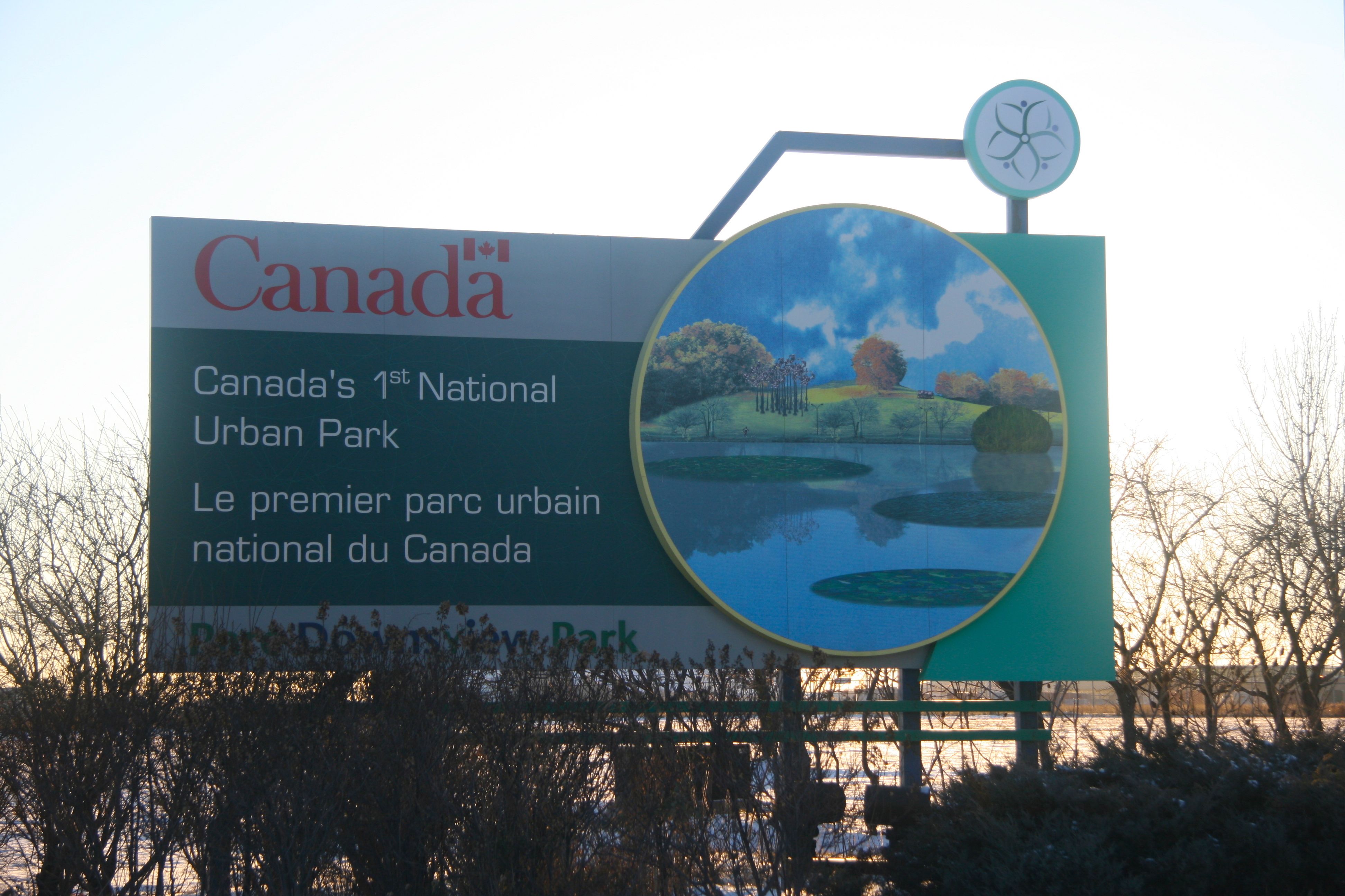
Mr. Bell even acknowledges that Downsview, which is billed as “Canada’s first urban national park,” is actually suburban, meaning its relationship with the car also poses big headaches. “Parking is kind of a conundrum for us, but we definitely won’t let asphalt become dominant,” he says, adding that the world’s great urban parks were established before the car was king.

One proposed partial solution, which mixes with the overall park vision of economic and environmental sustainability, is to further develop residential and commercial uses on about 300 of the 600-plus acres to finance Downsview’s development. That would enhance the “live-work-play” goals of the design, and make Keele and Sheppard a high-density intersection.

“The only solution to sprawl is intensification, and [Downsview] can play an important role,” Mr. Bell says, although he can’t give a precise local population goal.

“Logic would suggest we need a lot of residential activity,” Mr. Godfrey says, “but who wouldn’t want to live next to a fabulous park?”

How far must Downsview go if it is to rival New York’s Central Park?

Toronto officials don’t have an estimate for the number of residents able to walk to Downsview within 10 minutes, but it’s likely fewer than 10,000. New York officials say there are 750,000 residents and 36 subway stations within a 10-minute walk of Central Park. Several hundred thousand more work in the area and do things such as eat lunch in the park when the weather is nice.

“Project ahead 25 or even 100 years,” Mr. Bell says when presented with the comparison. “When Central Park was proposed, it was way the hell out in the boonies. Downsview will eventually be viewed as central to the [Greater Toronto Area] rather than northwest. In estimates for increased [GTA] population, you’re talking of up to two million additional people in the next 20 to 25 years.”

How is Downsview to capture the imagination of Canadians and potential tourists from other countries? The question matters because it is to be both a national park and — its boosters hope — eventually considered among the world’s great urban parks.

Much of the plan focuses on making the place a world leader in environmental technology.

There has been talk the park could be central to an “urban sustainability-themed” World’s Fair bid for 2017, the sesquicentennial of Confederation. Mr. Bell said he would encourage the idea, but even if it never comes to pass, he wants Toronto, through Downsview, to earn an international reputation as “a hothouse for the convergence of green theory and practice.” For example, he says, the park’s commercial component will attract “leading-edge businesses committed to sustainability.”

Mr. Godfrey says the residential and commercial components of the plan, which wrap the north end and southwest corner of the park, are evidence that Downsview’s planners are taking the question of the green space’s environs seriously.

“I’m anxious that we give a lot of attention to these areas,” says Mr. Godfrey, who hopes to take in the area on foot for the first time come spring. “The next challenge is to really get something happening.”

The plan for the major green spaces, the area Mr. Godfrey hopes to see under construction by the end of the year, would include an environmental study zone at the south end; wildflowers, walking areas and the Great Lake (a 300-metre long pond) in the middle area; and the Action Zone to the north, expanding on an already functioning national sports centre.

People who have avoided Downsview, or who have images of the place culled only from a passing car or from TV clips of Mick Jagger or the Pope, might be surprised to learn the Hangar, which plays host to enthusiasts in soccer, beach volleyball and archery, draws an estimated 300,000 visits a year. There’s a film studio and an aerospace museum that fits with the site’s ties to the old Royal Canadian Air Force and airplane manufacturing by de Havilland and now Bombardier.

Downsview has been a destination in recent years for school field trips, and there are four seasonal festivals, including the fifth annual winter one next Saturday, with music, sleigh rides and ice sculpting.

It adds up to possibly a million visits a year; small potatoes next to New York’s Central Park, which is said to get at least a million visits a day. But Downsview boosters see it as a great start.

“There really is a lot going on, even if the public can’t see it yet,” Mr. Genco says. And even if he hasn’t convinced his mother, he says his seven-year-old daughter, who plays soccer at the Hangar, “already sees this place as a park.

“She loves it, she really does.”
Categories
Urbanism

The Death and Life at 50

Portrait of Jane Jacobs by Hilary Forrest

The article first appeared in The Globe and Mail on May 7, 2011

Jane Jacobs’ first book is debated, dissected, deified and despised. But 15 months before her death, she sounded disappointed over its limited impact

By STEPHEN WICKENS

If you’re like me, calls out of the blue from the great thinkers of the age come as a surprise.

But Jane Jacobs, celebrated author of books on urbanism, economics and philosophy, phoned The Globe and Mail one afternoon in early 2005, asking questions about a seemingly minor point in a feature I’d written.

Census data showed that some of Toronto’s densest wards had low percentages of people living in buildings of five or more storeys, while several wards with the greatest proportions of high-rise residents were among the least dense.

“That’s a real nugget,” she said, adding that, “for a web of reasons,” lot sizes and building heights often matter less to density than the amount of land used for driving and parking. “This is important.”

Ms. Jacobs was 88, had 15 months to live and her final book, Dark Age Ahead, was behind her. But 44 years after publication of her once-revolutionary treatise, The Death and Life of Great American Cities, she was still seeking “nuggets” to help explain cities as “problems of organized complexity”.

It was a mission till the end and she sounded as if she feared cities and The Death and Life might never be widely enough understood. She expressed concern, in part, because media, even the venerated print institutions, were increasingly opting for the simplistic.

And that was back before anyone had heard of Twitter.

WALKING AND TALKING

This weekend, in an example of old-style social networking, groups of people in 16 countries will honour Ms. Jacobs’s ideas by walking and talking. There were just 27 Jane’s Walks in the first year, 2007, all in Toronto. It would undoubtedly please her that nearly 500 are registered for 2011, with 36 Canadian cities hosting 397 walks.

“People close to her felt she wouldn’t want a monument or her name on a park,” says Jane Farrow, a former CBC broadcaster and pedestrian activist hired to run the Jane’s Walks program. “The sense was it would be more fitting to get people out walking, connecting with neighbourhoods, discussing her ideas.”

Not that Ms. Jacob’s ideas appear likely to slide into obscurity.

This spring sees two new books of essays, Reconsidering Jane Jacobs and What We See. The latter is laudatory; the former has already upset Jacobs fans even though it won’t be published till June.

Urban designer and longtime Jacobs friend Ken Greenberg’s overtly Jacobsian Walking Home comes out this month. In September, Random House will release a 50th anniversary edition of The D&L, which still sells well in 15 languages. Calls are out for academic papers tied to the anniversary and HafenCity University in Hamburg, Germany, will host a “Queen Jane Jacobs” conference next week.

At least three major books last year dealt extensively with her ideas, including Makeshift Metropolis by Canadian-raised architect and author Witold Rybczynski of the University of Pennsylvania, Triumph of the City by Harvard economist Edward Glaeser and The Battle for Gotham, by New York-based critic Roberta Brandes Gratz.

‘NICE WORDS’

Ms. Jacobs had no time for ideology – left, right or whatever. Though warm and generous, she guarded her time and didn’t suffer fools. She seemed to be without ego and she hated it when reporters called her an “urban guru.” A mildly reverential comment about The Death and Life in our January 2005 conversation seemed to wind her up.

“Oh come on, I’m weary of the praise,” she said.

Then, pausing repeatedly to formulate thoughts, she unloaded. “Nice words from politicians, planners and columnists hardly matter when we continually repeat mistakes we made decades ago. It’s like we made some progress then hit a wall. Many places still have zoning laws on the books ensuring we repeat the mistakes. The bureaucratic machinery enforces bad planning and design, and nobody thinks to question a property tax system that encourages sprawl and all its hidden costs.”

She felt many who invoke her name “cherry-pick ideas to suit their purposes.” That planners eventually came to accept the benefits of high densities was no consolation. “In the absence of a pedestrian scale, density can be big trouble,” she said. “Few people take the time to understand what mixed primary uses means; most overlook the importance of short blocks.”

“Maybe you kinda blew it,” I replied, mostly in jest. “You buried a crucial part of your thesis on page 150. Lots of people in power who need to read The Death and Life probably don’t reach page 150.”

She laughed, triggering a scary sounding coughing fit. When it was apparent she’d live, her first words were: “I know what you’re getting at, but I wouldn’t have written it any other way.”

Her longtime editor, Jason Epstein, would back her. He still says, “There was nothing to edit.”

Maybe. But many feel it’s crucial for all the world’s urbanites to understand The Death and Life, even if more than a few conclude the book is flawed. This might be trouble in an era of short attention spans.

REPEAT CUSTOMERS

Vancouver planning chief Brent Toderian, author James Howard Kunstler and former Toronto mayor John Sewell have read the book repeatedly. All understand Ms. Jacobs’s frustrations but seem more optimistic about the likely long-term legacy.

Mr. Toderian was introduced to The D&L through a first-year city-planning course at the University of Waterloo.

“Incredibly, it wasn’t a prerequisite, which I still rail about to my alma mater,” he says. “There isn’t a person or book more influential in creating Vancouverism than Jane and The Death and Life. I’ve heard that through generations of my predecessors – from saying no to freeways in the 1960s to a counterintuitive approach to movement that allows congestion to be our friend.

“I know what she means about people misunderstanding density, that’s why we emphasize density done well rather than density as a mathematical exercise. People round the world praise Vancouver’s livability and she had a big hand in it.”

Mr. Kunstler, known for pithy, entertaining planning books, including 1993 bestseller The Geography of Nowhere, says we still develop badly, in part, because “changing the predictable rules of a very profitable game would be a political problem.” But because Ms. Jacobs’s ideas are timeless he expects acceptance to grow as urban crises erupt in coming decades. “She might not be fully appreciated until 2061, but nobody threw a cocktail party for Galileo in his time.”

Mr. Sewell calls the lip-service paid to Ms. Jacobs’s ideas “tragic.” “In Ontario, I’m aware of no provincial policies and no official plans that reflect some of the key points she raised.” But he sees hope in “the simplicity and applicability” of her approach. “What she’s saying is, forget the theories. If you want to make really good cities, go out and look for yourself at good parts of cities, places that feel right. Figure out why they work then replicate them.”

SMART HOUSEWIFE

The first sentence of The Death and Life is: “This book is an attack on current city planning and rebuilding.” It’s no surprise that some in the field counterattacked, citing her lack of credentials. Ridiculed as a “housewife,” Ms. Jacobs had taken a few university courses but never bothered to graduate. Undaunted, the amateur would later challenge key assumptions of classical economics in the first two books she published after moving with her family to Toronto from New York in 1968.

Mr. Rybczynski says she had gaping holes in her historical knowledge, overestimated the influence of planners and underestimated suburbia’s lure. “Not everyone wants 24-hour street life and, unlike Greenwich Village, most working-class districts are depressing. It’s no surprise people would want to get away from that.”

But he calls The Death and Life “the dominant book about planning of the second half of the 20th century, perhaps of the entire century.” He also writes that Ms. Jacobs’ ideas on density, short blocks and mixed uses were used successfully to create Reston, Va.

Mr. Glaeser says the most important idea behind The Death and Life is that “cities are what real people make of them;” cities are not buildings and infrastructure. “Her other themes, short blocks, the connections between buildings and the outside streets, mixed uses and density, are all fundamentally part of understanding what makes neighbourhoods work. The message has, by and large, gotten through in the planning community.”

But Mr. Glaeser also argues urban areas must get much denser for environmental and economic reasons and that healthy city cores are prohibitively expensive, in part, because Jacobs followers rule the day on preservation and height.

“She was too afraid of new buildings, too afraid of height and high density.”

Mr. Glaeser is a big Jacobs fan, but his comments have sparked debate. In a recent speech in Toronto, Ms. Brandes Gratz called some of his criticisms an “outrage,” while Mr. Sewell says Mr. Glaeser “has so misinterpreted Jane’s beliefs on density and tall buildings, it’s stunning.”

Mr. Glaeser vehemently stands by his words. He also says “I can’t help thinking she wouldn’t be pleased that the Greenwich Village of her day, which was affordable to ordinary New Yorkers, is a preserve of the ultra rich, where townhomes start at $5-million.”

Ms. Jacobs, however, felt affordability issues in gentrifying places backed her arguments about which neighbourhoods work.

“Until the car became a factor, we built primarily for pedestrians. “Those places are capable of self-regeneration.” she said in a later 2005 discussion, adding that costs soared because “we stopped building places worth gentrifying, so demand far and increasingly outstrips supply.”

FOUR CONDITIONS

There are countless intertwined concepts in The Death and Life and no room to explain “border vacuums” or “cataclysmic money” in a newspaper.

Page 150 lists four conditions needed “to generate exuberant diversity in a city’s streets and districts.” They are, in order: primary mixed uses that ensure people are outdoors on different schedules for different reasons; most blocks must be short; buildings must be of various ages; sufficient density.

Because we can’t have old buildings in all areas of rapidly growing metropolises, she felt mixed uses, short blocks and density are doubly important and that ensuring these newer areas accommodate various levels of income and commercial rents was indispensable.

Her comments about simplistic urban affairs journalism came with her defence of the book’s structure, including the buried thesis.

“Part of the reason cities are so poorly understood is that even newspapers are usually only capable of covering simple problems or problems of disorganized complexity.

“If you’ve read to the last chapter, you know cities — their parks, transportation planning, development policy, density ratios … are, like the life sciences, problems of organized complexity. It’s no good wishing it were any other way.”

I neglected to ask her if we need a special multimedia Death and Life, but Mr. Epstein, her longtime editor fears such a project would be superficial.

“Jane’s work is really a very subtle attempt to show how civilizations form, whether on the scale of neighbourhoods or eons. This would be hard to convey in a different format.”

Hard, yes, but it’s also no good wishing that new media applications won’t be essential The Death and Life’s afterlife. 

Categories
Toronto Transit Urbanism

Rapid transit? Not on Spadina

Soon-to-be passengers wait as a red light holds up a northbound 510 streetcar at Dundas. Service is slow on this “rapid transit” route because streetcars regularly have to stop twice at intersections, once for the light and once for the passenger platform.

This story first appeared May 7, 2005, in The Globe and Mail. I got threatening and unpleasant phone calls in the weeks that followed (a couple from city councillors) because the St. Clair ROW debate was then at fever pitch. The TTC, which stonewalled on documentation and interview requests, complained, but could find nothing inaccurate. Luckily I worked for a great editor. Left out of the story was reference to a 14-week survey of Bloor-to-Front travel times in which the 511 Bathurst proved to be, on average, 191 seconds faster. A few months later, a TTC source tipped me off that the TTC would reprint its maps to show this route as streetcar rapid transit, even though “they know it was the TTC’s slowest route between the Bloor-Danforth and Queen Street.” The only things I’d change in hindsight would be to make clear that for pedestrians Augusta is 90 seconds closer to Spadina than Bathurst (strengthening the point), and I’d provide details of how misleading the claims are that Spadina ridership soared. City staff have said signal priority, mentioned as a potential solution, won’t work on Spadina because the east-west light cycles are minimum length for pedestrians for a street that wide, and that it would conflict with signal priority on east-west streetcar routes. Work started on the story in January, 2005, with the release of a city/TTC report titled Building a Transit City. More than a decade later, I stand by every word.

By STEPHEN WICKENS

Arja Chopra has given up on the Spadina streetcar, just as the Toronto Transit Commission appears set to fully embrace similar dedicated-lane routes across the city.

Bathurst is faster, and it’s much more pleasant than Spadina,” says Ms. Chopra, who operates Sugar & Spice, a health-food store in Kensington Market, part way between the two streetcar lines. “I tried [Bathurst] because I didn’t like the crowds at Spadina station. Then I found it saved me a few minutes each morning.

“He didn’t believe me,” she says, smiling and pointing to husband and business partner Dave Chopra.

“It’s true,” says Mr. Chopra, who adds that he always urged his wife to take Spadina, figuring that the street’s dedicated transit lanes had to make the trip faster. Now he’s convinced they don’t, but he’s puzzled by one thing: “How can there be such a secret? Everybody still thinks Spadina is better.”

Maybe not everybody, but rare are the people who question whether the 510 Spadina route has really been the better way since it replaced the No. 77 bus almost eight years ago, at a cost of $140-million. As Toronto considers constructing Spadina-like rights of way as part of a $600-million citywide “surface rapid transit” network that could see dedicated lanes along Eglinton and Lawrence Avenues and on Don Mills and Kingston Roads, the question is critical. And the answer might surprise.

In January, shortly after the Toronto Transit Commission released a report calling for transit rights of way on these arterial roads, The Globe and Mail tried to assess the effectiveness of the Spadina line. Shown the results, opponents of the proposed right of way on St. Clair Avenue West say they now wish they’d asked more questions about the Spadina route during debates about the St. Clair plan. And a transit expert thinks the findings could place the $65-million St. Clair project in jeopardy.

We found that:

– Instead of living up to pre-construction reports that streetcars on dedicated lanes would cut travel time from Bloor Street to Queen’s Quay by 5 minutes — the original environmental assessment boasted of up to 10 minutes in savings — the 510 appears to take longer than the buses that plied the route from 1948 to 1997. A TTC document obtained last month says the trip takes one minute longer in the afternoon rush hour than in 1990. Run time data on historical and current transfers indicate a 17-minute bus trip in 1993 now takes 19 minutes by streetcar.

– The 510 may be the slowest of all routes between the Bloor-Danforth and Queen Street. Travel times on TTC transfers put Bloor-to-Queen trips at 12 minutes on Spadina, 8 minutes on Bathurst and 10 minutes on other routes.

– The TTC says ridership on Spadina is up 30 per cent since 1997, the year the line opened. But when compared with 1992, the last year before construction tore up the street and cut into ridership, Spadina is actually down 1.5 per cent, while overall TTC ridership is up about 3.4 per cent.

– TTC cost-to-revenue ratio lists show the Spadina and Harbourfront lines (now considered one for accounting purposes) have plunged to 35th-best among the TTC’s 132 surface routes. In 1997, they were No. 1 and No. 9, respectively, with the Spadina bus one of only seven routes turning a profit.

The only finding that Mitch Stambler, the TTC’s manager of service planning, strongly disputes is the question of whether the streetcars are slower than the old buses, although the numbers we’ve used came from the TTC.

But he says that speed isn’t the primary goal of the new dedicated lanes. “We have emphasized over and over again that on Spadina or St. Clair or any other route where we’re looking to establish a right of way, it’s not an issue of speed,” he says. “Service reliability and regularity matter first and foremost.”

Still, he says, the TTC is working to speed up service through gradual changes that include increasing capacity by coupling streetcars and acquiring new cars that accommodate more passengers, as well as providing more locations where operators can manipulate traffic lights.

Ridership on all routes is subject to “many, many macroeconomic factors,” he says, arguing that “apples-to-apples” comparisons aren’t always possible. And besides, he adds, the streetcar lines have benefits that extend beyond passenger numbers. “We’ve never argued that streetcars don’t cost more to operate than buses,” he says, pointing out that they’re still a bargain compared with subways, which cost about 10 times as much to build. “But all the benefits they bring — a smooth, quiet ride; zero emissions; economic development — are well known.”

While Mr. Stambler doesn’t sound worried about our findings, people from both sides of the St. Clair debate had a stronger reaction. “Good God! This is unbelievable,” said Ed Levy, an internationally respected transportation planner and engineer who made a deputation to City Council in favour of the St. Clair plan last year. “I supported light rail then, and I still do,” Mr. Levy of BA Group says. “But you have to do it properly.”

One concern he cites is the built-in delays caused by the positioning of passenger platforms, which should be placed before traffic lights, he says, but instead were put in after them to accommodate left-turn lanes for cars. “We’re forcing [streetcars] to wait at lights before they can pick up and drop off passengers on the far side of the intersections. It’s a mistake, and it looks like they plan to do the same thing on St. Clair.

“All this other stuff [Spadina travel times, ridership and economics] should have been part of the debate,” Mr. Levy says. Now, he says he fears the provincial Ministry of the Environment will call for a full environmental assessment rather than continue to fast-track the process. “They want to start construction this summer, and a full EA will probably kill [the plan] altogether.”

Of course, if the city and TTC’s ideas for St. Clair die, it would please Save Our St. Clair leader Margaret Smith, who says “the so-called Spadina experience and all its wonderful successes were used to sell the project every step of the way.”

She and her group believe advocates oversold potential time savings on St. Clair and ridership-growth figures on Spadina, and says she’s upset that the TTC and the city didn’t mention the streetcar line’s drawbacks in more than 50 public meetings about St. Clair.

“It doesn’t surprise me, but the fact this information is only coming out now is just further proof that the whole process stunk,” she says.

Mr. Stambler defends the TTC’s push for dedicated lanes, however, saying that the round-trip time from Spadina station has actually improved. “That’s a fact I’ll do a bit of digging on,” he says.”The fact that [Spadina] revenue over cost looks worse is: A, no secret; B, we’ve never hid it; C, we’re not embarrassed; and D, it represents an investment in the health of the city and the whole TTC, and that’s a decision council made.”

Mr. Stambler points out as well that the Spadina route became more costly because it went from bus to streetcar, but that this won’t be a factor on St. Clair.

Two others who had roles on opposite sides of the St. Clair debate didn’t sound at all surprised that Spadina doesn’t appear to have lived up to its hype. Richard Gilbert, research director for the Centre for Sustainable Transportation and a former city councillor, opposed St. Clair partly because he feels we haven’t learned from mistakes on Spadina.

“They may have built dedicated lanes for streetcars, but the intersections were designed for cars,” he says. “The St. Clair plan will do much the same thing, and it will only add to the litany of misapplied capital spending the TTC has given us in the past 30 years.”

Greg Gormick, who wrote a report called The Streetcar Renaissance for the TTC and the St. Clair EA process, says if we want any of these lines to really work, we have to make hard decisions.

“We have to decide whether we’re doing light rapid transit or streetcars. Both are good concepts, but Spadina is neither fish nor fowl — too many stops, too many concessions to cars. It’s the worst of both worlds and … unless we give transit real priority, we’ll repeat the mistakes, starting with St. Clair.”

And back at the health-food store in Kensington Market, Arja Chopra has a decision to make, too.

“They’re going to tear up the tracks on Bathurst this summer. I’ll probably use the replacement bus. We’ll see how it goes.”

Categories
Toronto Transit Urbanism

Urbanism’s wheels gaining no traction in Six Points interchange

Plans for a downtown Etobicoke, on the books for 40 years, might finally be seeing a little bit of action http://www1.toronto.ca/wps/portal/contentonly?vgnextoid=b4e98d0195ce1410VgnVCM10000071d60f89RCRD

Decades later, the lands around the old abandoned Westwood cinema in “downtown” Etobicoke present a bleak side of suburbia to passing motorists and the odd pedestrian. The condos under construction are close to the Kipling subway and GO Transit station.

This story first appeared in The Globe and Mail on April 16, 2005. Since then, a few condos have been built, but the 416’s commercial taxation disadvantages remain, as do the barriers to urban vitality created by highway-style ramps, railway tracks and a hydro corridor. It looks as if those trying to land a supermarket for Concert’s development had to settle for a Hasty Market. The litter remains, and it’s no fun being a pedestrian on this turf. Councillor Peter Milczyn won re-election in 2006 and 2010 and has since moved on to provincial politics. Getting a west exit from Islington station that goes under the CP corridor to serve the apartment neighbourhoods at Mabelle would be a huge improvement.

By STEPHEN WICKENS

David Holman can’t count the number of times he has driven through the Six Points interchange during 36 years living in central Etobicoke, but he’s certain he has never even considered walking through it.

“I have noticed a few people scurrying to get across the roads, and it doesn’t look like fun,” he says.

The retired accountant’s description may be a marvel of understatement: A steady stream of traffic whizzes through the interchange at most times of day, heading north and south on Kipling Avenue, east and west on Bloor and Dundas Streets and around in sweeping arcs on adjoining ramps surrounded by litter-strewn patches of lawn.

Fearful pedestrians may shun the 1950s tangle of asphalt, and drivers may take it for granted, but pay attention to the Six Points for the next few years and you may see the fiercest battle yet in Toronto’s attempt to turn the tide of runaway sprawl and deepening car dependence.

The city wants to remove the interchange as part of its Etobicoke Centre plan, a blueprint for the next attempt at creating a downtown in Greater Toronto’s suburbs. And while some question whether planners have had much success at developing downtowns in Scarborough, North York and Mississauga, the city’s assertive-sounding official plan states that “the area will develop the feel and function of an urban core,” and that “walking will be an interesting and pleasurable experience in Etobicoke Centre.”

But area residents aren’t so receptive to that idea. Opening shots were fired at a public meeting in 2004, when some concerned residents had to be turned away from an overcrowded Legion hall.

“The people weren’t rowdy,” says Islington Residents and Ratepayers Association director Bob Berry. “But they had a message: Six Points works as it is. I’d say 95 per cent agreed. We’ve had our discussions, and the response always seems to be that people don’t walk any more, they drive. If the city wants to push, there will be a fight.”

Ward 5 City Councillor Peter Milczyn knows there is substantial opposition and says the city is taking seriously “legitimate concerns about traffic spilling over onto residential streets.” But he supports the city’s intent and doesn’t sound willing to back down, even with elections set for next year.

“What was built there was a horrendous mistake and to not try to correct it when there’s an opportunity is irresponsible,” Mr. Milczyn says.

The opportunity he speaks of comes as part of a push to finally act on plans — nearly three decades old — to create a 2.8-kilometre-long, 420-acre downtown between Montgomery Road, east of Islington Avenue, and Shorncliffe and Shaver Roads, west of Kipling.

Already, as many as 5,000 residential units are planned, under construction or recently completed. Land surrounding Islington subway station is to be freed up for a mixed-use high-rise project by moving commuter lots and the Mississauga Transit bus terminal to Kipling.

The city plans to reconfigure the 10-acre Six Points site into a web of walkable city streets with buildings that extend to the sidewalks.

“The city has a key role here. We are the biggest landholders,” Mr. Milczyn says. “If we do this properly, if we create a real live-work-play mix and make it a pleasant walk to and from stores and restaurants, the subway and GO trains, people will get out of their cars. Visitors and office workers will arrive by transit — it will help the city, the TTC and the environment.”

But while Mr. Berry likes much of that vision, he thinks Mr. Milczyn is dreaming if he thinks people will ever give up driving. “And if you take out the Six Points, where’s all that traffic going to go?” he asks. “Who wants to live through the construction and disruption?”

John Alkins, a real-estate broker and the chairman of the Village of Islington Business Improvement Area, thinks cost might kill the Six Points plan. “But either way, development is coming, and for all the right reasons,” he says. “The key is not to have this so much as a place for people to drive through, but to make it a destination.”

Before the car was king — when the Six Points site was a rural crossroads called Wood’s Corners — suburbs gradually urbanized as a matter of course. Since the Second World War, steady road building has made it possible to perpetually develop at low densities with land uses so segregated that car dependence is unavoidable.

Even with infill and public transit expansion into Etobicoke, North York, Scarborough and Mississauga, the old City of Toronto remains at least twice as dense as the older suburbs. And the downtowns of Scarborough, Mississauga and North York remain largely car-dependent, even with two subway lines meeting in North York’s case.

So can we go into areas built for the car and create, as the city hopes, “the feel and function of an urban core?” Can we ever “make walking interesting and pleasurable” if residents insist on priority for cars?

“You can’t foist things on people,” says Anne Milchberg, a City of Toronto real-estate manager and former planner who is deeply involved in the Etobicoke project. “But I think many are starting to see the value in having proper urban fabric. Whether that will ever weigh more than things such as road capacity, I don’t know. But I see encouraging signs.”

In the case of Etobicoke Centre, she says the fact the city’s works and emergency services departments would even consider trading Six Points for urban form is “a huge and positive cultural shift.”

Her hopes for Etobicoke Centre are also buoyed by two “organic shopping strips” — Bloor east of Islington and Islington Village, east of the Six Points on Dundas. “They’re already walkable, older-style places. It seems easier to graft onto something organic than to create planned places from scratch.”

But Etobicoke Centre faces hurdles besides Six Points. Most developers appear willing to build only high-rise condos in the area, rather than mixed-use projects that also cater to businesses, largely because tax rates on office and commercial properties are cheaper in nearby Mississauga..

As for retailers, most seem reluctant to deviate from the big-box model, especially in an area that can’t claim to be urban yet. Concert Developments, which is going through a site-approval process to build up to 950 units of seniors’, condo and market-rental housing east of Six Points, tried to comply with city requests to include an urban-style, pedestrian-friendly supermarket. But Concert’s Brian McCauley says the grocery chains are interested only in a suburban format surrounded by lots of parking.

“We approached them all without any luck,” Mr. McCauley says. “There will be a food store, but it won’t be what we’d all like to see.”

Another concern is the unpleasant walk between Islington station and neighbourhoods northwest of the CP and subway tracks. “That’s a deterrent to pedestrians, not unlike Six Points,” Ms. Milchberg says. “We’re working on ideas.”

But she is confident about urbanizing Etobicoke.

“This isn’t just a Toronto-area puzzle,” she says. “I don’t know of any city that has created truly lively, pedestrian-friendly places in its suburbs — at least since cars became so dominant. But we are learning. We’re chipping away and some of us are approaching Etobicoke with the hope this can really be the one, and that [other cities] might look to this as a model.”

Categories
East End Toronto Toronto Transit Urbanism

TTC forced to mop up when planners and architects fail

Even if Variety Village’s isolated design was painfully ironic, it can make an otherwise complex transit service and funding conundrum accessible to all

Variety Village was originally dumped between two four-lane highways, then rebuilt in the early 1980s with its impregnable backside largely hidden but facing the TTC's longstanding stop on Kingston Road. Now that most buses are diverting to serve the other side of the building, residents of the Glen Everest neighbourhood have absorbed the headache.

By STEPHEN WICKENS

On the surface, Variety Village’s nearly 30-year push for a somewhat convenient bus stop was a no-brainer, but this is one case where blaming the Toronto Transit Commission is flat out unfair.

Sure, I had fun with tabloid journalism during a stint at the Toronto Sun in the 1990s, so I can understand the World War III-sized headlines and the crusading rhetoric the paper used last year to label TTC “drones” as “heartless” and the commission’s initial decision to merely study a route modification as “a kick in the teeth” for the disabled.

But there’s much more to the story and understanding the genesis of this battle matters to everyone in Greater Toronto. This is one of those rare examples that make a complex public policy problem reasonably comprehensible.

The Variety Village mess is rooted in the 1940s, when the province donated to the cause some land left over from construction of an interchange for Highways 2 and 5, better known these days as Kingston Rd. and Danforth Ave. Premier George Drew undoubtedly had good intentions, but when his people determined the original facility would be built on a steep slope between two four-lane highways, he may as well have been telling disabled kids to go play in traffic.

Although we didn’t start buying low-floor buses until the 1990s, there was a chance to address the accessibility disconnect in the late ’70s, when Variety Village shifted away from its role as a vocational training centre. The new focus on the physical, recreational and mobility needs of the disabled required a rebuilding program, which, with a little thought, could have created a connection with the surroundings.

Instead, when Premier Bill Davis opened the new facilities, media were told about wonders such as “adjustable disembarking ramps” for wheelchair vans. Nothing was said about those who would get there by TTC. “The building was designed so a person with any kind of disability can move and function without help or embarrassment,” officials boasted.

That’s likely still the case — once you’re safely on the island.

The new structures may be Toronto’s finest example of architectural irony. The “model of accessibility,” a place dedicated to helping the disabled fit seamlessly into our community, looks and functions more like a fortress on a hill. A walk from the long-standing Kingston Road bus stop to the entrance is a good four-minute climb over tough terrain — for a fully mobile adult, in good weather.

Variety Village may not have been able to hire the best architects, but shouldn’t those who okayed the plans have given primary consideration to an entrance close to and level with the Kingston Road bus, the only TTC route serving the property?

With hindsight, it’s obvious the new building should have gone atop or next to a subway stop, even if it cost more initially. It’s painful to think that Kennedy station, still surrounded by underused lands 30 years on, was built the same time as Variety Village.

It’s more painful to consider this is far from an isolated case and there’s no end of stupidity in sight. Post-secondary students often can’t afford cars, but since World War II we’ve marooned most new campuses where quality cost-effective transit is impossible. We put York University on farmland north of the city, then spent 50-plus years discussing an incredibly expensive subway extension to fix the mistake. We did it again recently with the University of Ontario Institute of Technology, which could have helped revitalize Oshawa’s downtown or gone atop the GO station and its acres of parking. Instead, UOIT is in the city’s car-dependent north.

A wave of boomers is about to retire and many will end up unable to drive, but living in places designed for cars. Our kids are victims of unnecessary inaccessibility, forcing us to spend fortunes in time and money ferrying them to school and other activities.

Variety Village is a world-renowned contributor to our community – an institution whose fund-raising has been killed in recent years by lotteries and casinos. Even if it has contributed to some of its own problems, it deserves good transit access and our support. It’s nice to see that the TTC has applied a Band-Aid — though transit-dependent residents of the Glen Everest neighbourhood probably disagree.

But the larger lesson for all of us is, greenbelt or not, if governments allow or inadvertently promote office parks, big-box malls, colleges, subdivisions and condo towers where cars are essential, we guarantee taxpayers will get far less bang for the billions of bucks that may or may not eventually flow through the TTC and Metrolinx.