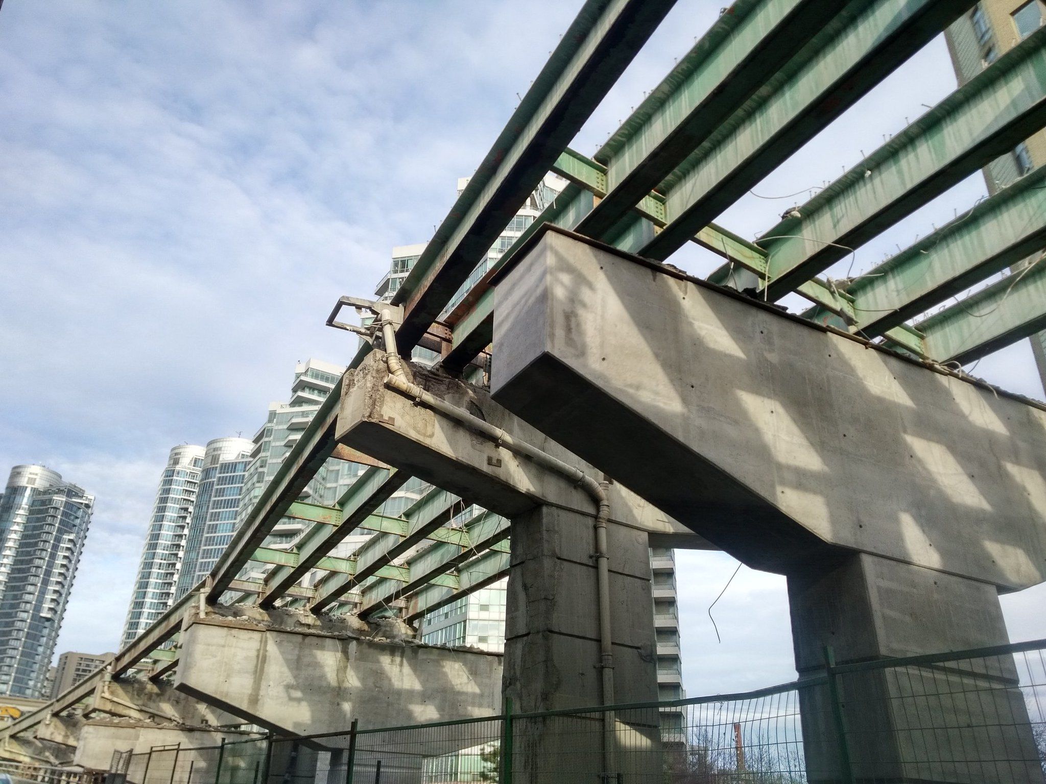
The York-Bay-Yonge ramp demolition is proceeding quickly. Peter Baugh photo @PWBaugh
By STEPHEN WICKENS
On Monday, eight days after the end of the world, a Toronto TV newscast was still making a fuss about the shutdown of a Gardiner Expressway ramp that had been, until April 16, funnelling 21,770-plus vehicles onto York, Bay and Yonge streets on average weekdays.
“Car-mageddon” forecasts began in earnest on Feb. 8, with Mayor John Tory making a stern, brows-knit announcement. “I’m not going to sugar-coat this,” he warned, conjuring memories of newsman Ted Baxter from the old Mary Tyler Moore Show.
In March, Wheels, the Toronto Star’s largely advertorial automotive section, published a rant under the headline “York-Bay-Yonge ramp demolition will equal traffic chaos for downtown Toronto.”
Then, in the final days before the Y-B-Y ramp closed, local media outlets revved up the coverage – lots of interviews with concerned and angry expressway users interspersed with bureaucrats explaining that the ramp is 50 years old and crumbling.
One official, apparently unaware that relatively few of Toronto’s downtown workers arrive on the eastbound Gardiner, said “we’ll all just have to bite the bullet.”
I hate sitting in traffic as much as the next guy, (part of the reason I rarely drag tons of steel, glass, rubber and plastic with me when I go downtown). I own a car and I’m sympathetic with co-workers made late by congestion. I very much appreciate that there’s a significant group of people whose livelihoods require they drive into and out of the core.
Yet for all the media coverage, I haven’t seen a story that puts into context the degree to which closing this two-part ramp will crimp the transportation network during the eight months needed to build the replacement exit at Simcoe (apologies if I missed it).
After a few emails, phone calls, a little Googling and some rummaging through the home-office filing system, I’d classify the ballyhooed ramp-gridlock-crisis story as much ado about relatively little. Rather than chaos, what I see is merely more evidence of just how self-defeating car-based transportation is as a major mode in an urban context.
City staff tell us 1,537 cars were using the old ramp in the busiest 60 minutes of the a.m. rush on an average weekday. That’s less than a quarter of the average number of people who emerge downtown from each of the TTC’s seven core subway stations (Dundas, Queen, King, Union, St. Andrew, Osgoode and St. Patrick). The seven-station peak hour total is 43,295 arrivals (28.2 times the ramp number) (1).
Over the three-hour a.m. rush, the Y-B-Y ramp sees roughly 4,500 vehicles (2), while each of the seven core stations averages 14,910 people. That’s 104,352 total, 23.2 times the ramp number.
Looking at the 24-hour period, the ramp’s 21,772 total is less than any of the seven aforementioned stations (even though the subway is shut for about four hours each night). The seven-station total is 412,472, or 18.9 times the ramp number.
Not including GO and Via, 6.9 times more people get off at Union station’s subway platforms in the a.m. peak hour than the number of cars passing through the ramp. In the 20 hours that the Union subway platforms are open, they handle 118,446 people, 5.4 times the number of vehicles using the ramp over 24 hours.
And none of this includes the roughly 89,000 who travel downtown by GO Transit on an average weekday (3), or the tens of thousands more who arrive by TTC surface routes, on bikes and on foot.
In fact, as urban planner Gil Meslin (@g_meslin) tweeted in response to this post: “That peak-hour ramp usage is less than the number of people disembarking from one full GO train at Union Station.” A GO train can carry 1,670 people.
(And we haven’t even mentioned the TTC’s two busiest stations, Bloor-Yonge and St. George, neither of which is really in the core. Bloor-Yonge, BTW, handles 18.3 times as many people a day as the Gardiner ramp and, by one measure, more daily passenger movements than all of Union Station and Pearson Airport combined).
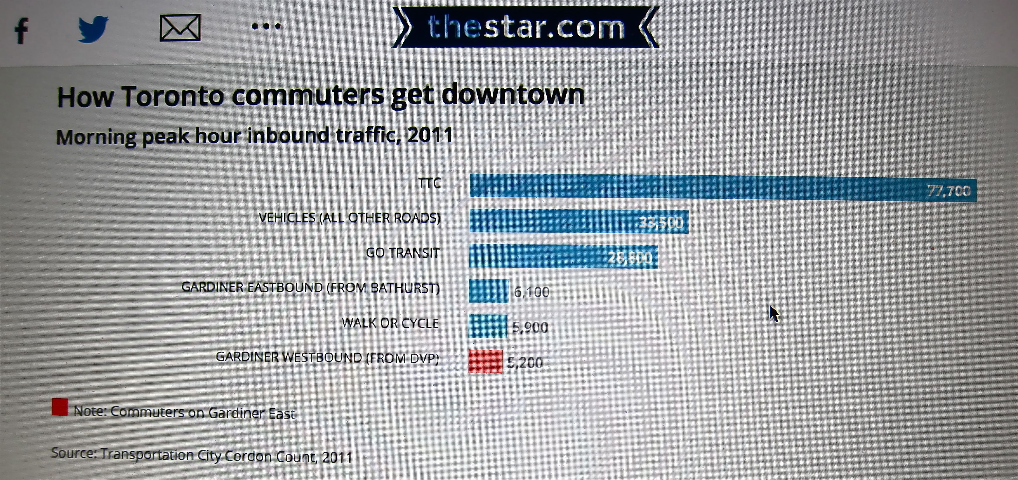
City data from 2011 measuring how people are getting downtown in the a.m. peak hour indicate that just 3.9 per cent are arriving on the eastbound Gardiner and the expressway as a whole is delivering just 7 per cent. Cyclists and pedestrians were at 3.2 per cent, and with the dual booms in condo construction and cycling those modes have likely since surpassed the eastbound Gardiner’s proportion of the total.
This Toronto Star graphic, produced using city data during the debate on the fate of the eastern Gardiner, illustrates just how little the expressway contributes to the core’s connection with the region. The peak-hour numbers are from 2011, so it’s likely that, with the dual booms in condo construction and bike usage, the pedestrian and cyclist total has well eclipsed the Gardiner.
Would media go this big if TTC had to temporarily shut a core subway station or GO was forced to remove a handful of train runs? Highly unlikely.
Over the decades, most of the city and its media have become inured to the core transit system’s overloading. Delays happen and people get mad but public transit is resilient. As long as we’re not totally shutting down what little subway infrastructure we have into Toronto’s core, we always muddle through.
So why the big deal over a single highway ramp?
Driving is so land-consumptive that you don’t need many cars to create serious congestion. Driving is also inefficient because it’s disrupted so easily, whether by regular volume, common fender-benders, basic maintenance and construction … or the occasional ramp shutdown.
And our media outlets, including many of the reporters and editors they employ, seem unable to see differences between the urban and suburban parts of the metro area, or even within the 416. Prevailing assumptions about the importance of cars to the older parts of the city, where so much of the economic engine resides, are wildly inaccurate.
We decry the billions of dollars that congestion is said to cause us, but through ignorance and cynical politics we continue to give priority to spending on a mode that guarantees congestion and inefficiency.
Thankfully, we don’t have room to widen roads in the city. But unfortunately, politicians – even conservatives who claim to be respectful of taxpayers – choose not to listen to facts or do the basic math when it comes to urban and suburban transportation issues. And our media, especially broadcast outlets, don’t put much effort into helping to seriously inform the public.
The result is that, to ensure we don’t inconvenience a small number of vocal drivers who have the ear of media and politicians, we’ve allotted $3.6-billion for rebuilding and adjusting the alignment of a short stretch of the Gardiner Expressway, yet we somehow still have nothing for a decades-overdue subway line through the core that can benefit the city and the entire region on a scale few can comprehend.
NOTES
1. The numbers of people arriving by car are surely higher than the number of cars. I’ll factor that in and adjust the totals when the city provides it’s updated formula. I asked last week, but so far no luck. From my files, city staff acknowledged at a Canadian Urban Institute event in 2005, that it assumed cars on local expressways carry less than 1.2 people during the a.m. rush and slightly less than 1.1 for the rest of the day.
2. The city suggested I multiply by three the 1,537 a.m. peak number to get the full a.m. rush total. I’m reluctant to do that because the shoulder times outside the actual peak hour will necessarily be less. If, for example, I multiplied the TTC’s a.m. peak numbers by three, the totals for the seven core subway stations would jump considerably. I went with 4,500, which is also what The Globe’s Oliver Moore did on April 15 (page M3, but apparently not online).
3. GO buses, of course, use the expressway system, though they are a tiny part of GO’s Union customers. Vanessa Barrasa of Metrolinx told me that, “In anticipation of the Yonge-Bay-York ramp closure, GO bus made some minor adjustments for trips arriving from the west. We have not had any major delays caused by the closure.”
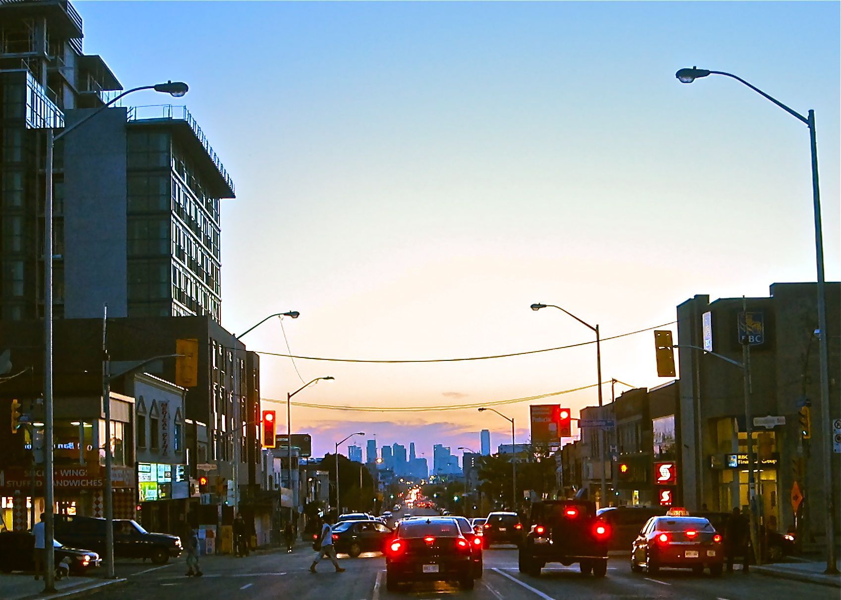
Danforth and Woodbine, looking west on Sept. 16, 2014, 98 years and 51 weeks after the photo below right. After about 60 years in decline, the area and this intersection are getting new investment and they are clearly on the way back.
Urbanist Jane Jacobs may never have written about the East Danforth, but after a few long walks on a Toronto strip that was in decline for much of the latter 20th century, she developed firm views on what is needed for revitalization.
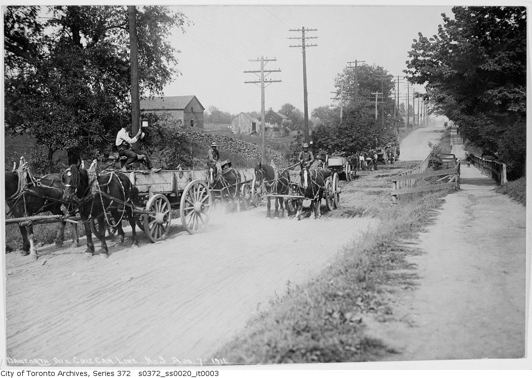
Danforth and Woodbine looking west, Sept. 22, 1915, with the new streetcar tracks and actual paving. (City of Toronto Archives photo)
By STEPHEN WICKENS
When the writing wasn’t going smoothly, Jane Jacobs would take a long walk. During one stretch of gorgeous fall weather in the early 1980s, with writer’s block delaying progress on Cities and The Wealth of Nations, the renowned author of books on urbanism, economics and ethics visited the Danforth “three or four times … the whole strip from Broadview to Victoria Park,” with several detours to the nearby rail corridor and the surrounding streets.
She never wrote about those Danforth jaunts but she spoke with me about the area in 2004 and 2005, while I was both writing Toronto features for The Globe and Mail, and working with people attempting to start a neighbourhood group (prior to the eventual and successful establishment of the Danforth East Community Association).
Watercolour of Jane Jacobs by Hilary Forrest
Though she was nearly 90, Jacobs’s memory was excellent. I was raised in the east end and live in the immediate area. I walk a lot, too. She visited a few times – decades earlier – yet what she said helped open my eyes.
In one discussion, she bristled and became animated when I mentioned the usual received wisdom, that the East Danforth’s seemingly mysterious decline in the second half of the 20th century was likely a result of transportation changes, most notably the replacement of streetcar service with the Bloor-Danforth subway in 1966 to Woodbine, and 1968 farther east. It is an enduring theory, given legs within weeks of the subway’s opening as media latched onto attempts by the area’s “business men’s association” and locals to restore some form of street-based local transit, either streetcars or buses, that would run parallel to the subway using existing, frequently spaced stops. The group produced a 15,000-signature petition (huge numbers for a small area in the pre-social media days), but the pleas were ignored at the Toronto Transit Commission.
Jacobs said far too much weight had been given to the arrival of the subway, and called it a ‘lazy man’s theory.’ She agreed that underground subway stations – spaced much farther apart than the old streetcar stops – sped the processes that were sucking life off the street (better planning for second station entrances could have helped a bit, in her view). But she argued that commercial strips of blue-collar neighbourhoods had gone into similar declines during the same era, “all over Toronto, the continent, even the planet – and almost none of these other strips would have had new subways.”
Commercial streets, an essential component of urbanism for millennia, had, in effect, been deemed obsolete in theory and practice, and the ramifications were both far-reaching and subtle.
The larger transportation-related factors in her view were that car ownership was soaring in the post-World War II era, and that people were suddenly traveling farther to shop – to malls and bigger stores where parking was easier. People also became increasingly less likely to leave home on foot, and whole neighbourhoods and cities suffered as a result.
“Transportation matters to the discussion, to be sure,” she said. “But if you’re serious about revitalizing this street, you’ll focus on broader changes to the overall local economy, and you’ll look for adjustments to form that will naturally attract pedestrians for day-in day-out reasons.”
Among the things that first struck Jacobs on her walks, especially east of Pape where the nature of the street changes suddenly, was the near complete lack of Victorian or Edwardian buildings. She also found a sudden increase in the lengths of the blocks (see No. 2 in her seminal list of conditions for generating diversity).
The district, and indeed as many of its internal parts as possible, must serve more than one primary function; preferably more than two. These must insure the presence of people who go outdoors on different schedules and are in the place for different purposes, but who are able to use many facilities in common.
Most blocks must be short; that is, streets and opportunities to turn corners must be frequent.
The district must mingle buildings that vary in age and condition, including a good proportion of old ones so that they vary in the economic yield they must produce. This mingling must be fairly close-grained.
There must be a sufficiently dense concentration of people, for whatever purposes they may be there. This includes dense concentration in the case of people who are there because of residence.
——————————————————————————————————-
She advised me to compare the block lengths east and west of Pape on a map. “Better still, walk and time them if you have the opportunity,” she said.
It turns out that most blocks on both the north and south sides of Danforth west of Pape, the much livelier Greektown neighbourhood, are no more than 100 metres and can be walked in a minute or less. Many to the east take two minutes or more. When we touched on this in a subsequent discussion she said I’d probably remember for the rest of my life that blocks in the liveliest places in cities all over the world will tend to be well under two minutes in length at my pace (see for yourself, no matter where you live or where you’re visiting). “Two-hundred and fifty or 300 feet is ideal in most cases.” (That’s 76 to 91 metres.)
But Condition No. 1 on her list, The East Danforth’s mix of primary uses, would in her view matter most to people puzzling over how to reinvigorate the area (the emphasis on the word primary was hers). She felt strongly that if redevelopments merely added residential condos with retail on the ground floor, we wouldn’t be adding the type of mixed use that could have a major regenerative effect. We might merely be adding to the number of empty stores, she said. And she warned that many “seemingly enlightened planners still tend to have a superficial understanding of what mixed primary use really means.”
Jacobs suggested I go to the Central Reference Library and use city directories and old maps as an introduction to the timeline of Danforth East’s development. Correctly, as it turned out, she told me to expect that the area was first developed largely in the 1920s, a point she said meant this was in fact a hybrid, not the pure streetcar suburb that some academics would label it. Private cars would have been a factor from the beginning, certainly east of Pape, even if the area had still developed largely around a main street on which streetcars arrived in 1915. She told me to look for evidence the area developed with a significant amount of employment, mostly industrial and most of it likely focused on the rail corridor to the south.
And it was there.
Prior to the area’s initial development, but well into the 20th century, lands on both sides of the East Danforth were largely operating as market gardens, providing fresh produce to the nearby city. Farming operations got larger farther north, toward the Taylor Creek valley, with several dairy operations in what was the Township of (and later the Borough of) East York, amalgamated into Toronto in 1998. Most of the area immediately north of Danforth had been Church of England reserves, known as the Glebe and usually leased to farmers. South of the Danforth (east of Greenwood and over to the town of East Toronto at Main Street), was known as Upper Midway, part of the Midway area annexed to the city in 1909. It was very rural compared with the main parts of Midway, south of the tracks, and it appeared as a virtual blank on maps as late as 1907.
Jacobs asked me to come up with a plausible explanation for the delay in development until after World War I, especially since areas farther from established Toronto had developed sooner (around the Grand Trunk/Canadian National station and yards at Main Street). I’m open to arguments, but it seems probable that the biggest delaying factor was that, east of Pape, five creeks crossed the Danforth (a.k.a. The Second Concession and later The King’s Highway No. 5). The railway tracks had also established themselves as a barrier. Though the tracks had brought the Town of East Toronto to life, the corridor barrier itself would increasingly become a drag on the area in the later 20th century, especially as it got closer to the Danforth heading east and as industry that once provided jobs in the area moved out to the suburbs.
Though the Danforth (originally the Don and Danforth Plank Road) had opened in 1851, the imposition of a concession grid, forced the street to follow a predetermined straight line, despite ravines and marshy areas that would not have been apparent in the kingdom’s Colonial Office in the 1790s. The road’s path was set decades before surveyors arrived. The Danforth was a nightmare to maintain (a job left largely to the farmers who used it and paid tolls — a source of protests and legal disputes). The rickety wooden bridges often got washed out. And even when they weren’t, travelers to the city still had to get to down to Queen, Gerrard or Winchester streets to cross the Don Valley.
Rickety wooden bridges on the east Danforth often washed out in storms. City of Toronto Archives photo
Even though streetcar service and proper paving came to the East Danforth in 1915, development didn’t happen until a housing shortage after the Great War and the opening of the Prince Edward Viaduct in 1919. Something that also held up residential development in the immediate Coxwell-Danforth area was a stench from the Harris abattoir and rendering plant, which was eventually driven away in the early 1920s (and though this is also a clear instance where employment and residential don’t work in close proximity, even the Harris plant attracted a small enclave of residents using kit housing just southwest of Danforth and Coxwell).
In the city directories, Jacobs suggested I look for trends related to the stores that sprang up: Aside from the fact that many merchants lived upstairs from their businesses, the most stunning thing was the lack of turnover. Vacancies were listed when buildings were new in the 1920s, but were almost non-existent again until the late 1950s. There was very little turnover among businesses through the Great Depression, 1940s and early ’50s, indicating a healthy local business environment despite great challenges facing the global macro-economies. Even when Woolworth moved from east of Woodbine to snuggle up next to department store rival Kresge in 1942, displaced shops found ways to stick around — some at Woolworth’s old site.
The variety of shops, especially close to Woodbine was remarkable. Though supermarkets in the 1950s were much smaller with limited offerings, there were nine of the Loblaws, A&P and Dominion variety from Greenwood to just east of Woodbine), as well as butchers, bakers and produce shops. There were also many clothing and shoe stores, and the three movie theatres would have contributed to sidewalk life in the evenings.
These were all things Jacobs expected me to find, and she said it was important to note that the turnover and vacancies started appearing well before any subway construction began, even if locals didn’t really pay attention to the strip’s decline till later. Some feared the subway would bring over-development, yet the opposite happened, and many are still astonished by the lack of development more than 50 years after the subway opened.
There is also a strong likelihood that plans for an extension of the Gardiner Expressway into Scarborough, through the neighbourhoods straddling the railway tracks, hung over the local real estate market in the 1960s and ’70s. Hundreds of homes were to be expropriated just for the interchange at Woodbine, not far south of the Danforth.
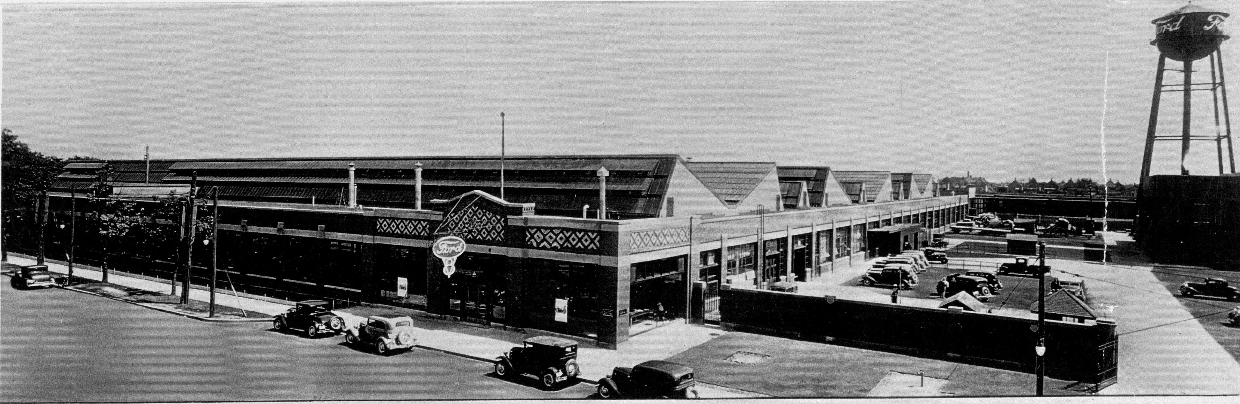
The main Ford of Canada assembly plant became Shopper’s World mall after the company moved operations to Oakville in the 1950s. The loss of jobs and the shift of stores from the street were “a double whammy” for the neighbourhood. PHOTO COURTESY FORD OF CANADA
As for industry and employment, there wasn’t so much right on the Danforth itself, though it’s worth noting that Canada Bread had its main Toronto plant just east of Greenwood (and the folks at the Linsmore Tavern said the plant workers kept them very busy on breaks and shift changes). Ford of Canada, before moving to Oakville in the 1950s, had its main operations at what, in 1962, became the Shopper’s World Mall, west of Victoria Park, right by the eastern loop of the streetcar line on a small strip where East York actually reached down to the Danforth.
Jacobs called the loss of that employment and the fact that some Danforth stores moved to the mall in the early 1960s a “double whammy” for the strip. Car dealerships and the TTC streetcar barns at Coxwell (now only partly used, and mostly as parking for subway staff) also brought lots of workers to the neighbourhood or provided jobs that local residents could walk to. And, of course, lots of people working in the area provided essential daily business for local shops and restaurants. Along the rail corridor, less than a half-kilometre to the south, were major industrial enterprises, including a John Wood plant on Hanson Street, the largest source of hot water tanks in Canada from the 1920s on. Service Station Supply was an assembly plant for gas pumps and hydraulic lifts. There was a factory producing stoves, washers, ‘ice boxes’ and fridges. There were many light industrial operations as well as quarries and brickyards on either side of Greenwood. Major suppliers of coal, lumber and other building materials were located all along the tracks from Greenwood to east of Main, where the CNR shops and freight yards began.
Jacobs wanted me to see that, while many preferred to drive out from of our neighbourhood the noise and trucks that increasingly accompanied industry, the shift to an overwhelmingly residential area quietly undercut essential facets of the local economy, including the shops and restaurants on the Danforth. The loss of industry meant the rail corridor bordering the southern parts of the neighbourhood shifted from attracting much economic activity to the East Danforth to being a barrier and a drag on the area, a hindrance to walkability and connectivity.
Late in the 20th century, even though household sizes got smaller, in pure residential terms the neighbourhood actually got denser because housing was built on former industrial land. But the mix of primary uses – usually residential and employment, with a few specialty shops or large theatres that can draw people from other parts of town – was getting badly depleted.
Looking forward, she said: “Residential density itself won’t be enough of an answer if you really want to create or recreate a vibrant neighbourhood,” she said, adding that residential density by itself, especially if it becomes high-rise, high-density could be a big problem if we don’t pay attention to all the generators of diversity.
On that count, she said the options are limited. There might be small gains to be had by breaking up some long blocks, but the new passageways or streets would almost certainly never penetrate more than a block or two into the surrounding neighbourhoods. Creating a deep inventory of buildings of different ages is a long-term organic process; the key would be to ensure that the 1915 TTC barns and much of the 1920s buildings be saved (likely not a problem with the fragmented ownership and often shallow lots). Density increases, especially right on the Danforth would be helpful, but we might need less than many think, especially if significant employment is included.
“There’s opportunity in bringing employment to sites at the subway stations,” she said (and she agreed that the TTC lands and some north-side parking at Coxwell and the Valumart parking lot at Woodbine are probably our only significant options for bringing mid-rise office buildings into the local mix. (Our discussion didn’t consider areas as far east as Main Square and Shopper’s World, but clearly, there’s redevelpment potential there).
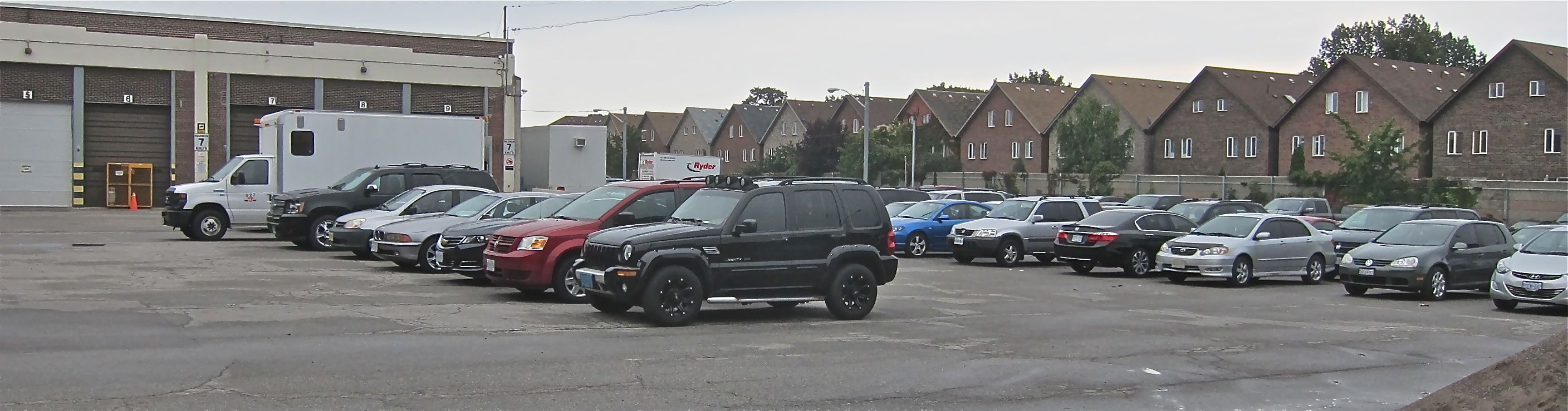
The five-acre TTC lands at Coxwell were used as a bus garage when Jane Jacobs studied the strip. These days much of the site is used, ironically, to provide free parking to transit workers. Shockingly for many, it’s larger than the Honest Ed’s site set for redevelopment.
She added that we were lucky to be approaching things at this time (she was speaking in 2004) because much of the GTA’s employment gains are likely to be in office work, and that even just a few mid-rise office buildings near the stations might bring enough workers to help “rebalance the local economy.”
Though she died in early 2006, Jacobs lived long enough to see a resurgence of life downtown when usage restrictions were lifted on “The Kings,” and when a new wave of residential development was able to complement the dense employment zones, allowing secondary-use shops and services to come back in the core. She saw it as encouraging.
Returning employment to the Danforth area could, in her view, have a similar effect (though on a much smaller scale) by getting more people out onto the sidewalks for different reasons at different times of the day, helping lots of small shops and restaurants to “get over the hump … it often takes just a handful of extra customers a day to make a difference in small-scale retail.”
She emphasized that year-round walkability relies heavily on people having regular economic reasons to be out on the local sidewalks. “You won’t get industry again, and few would tolerate it, but office work and some new residential density right on the Danforth could be great for the city and your area.” She felt the Avenues focus in the city’s Official Plan could be life-giving for the East Danforth.
She also noted that the Danforth has spare subway capacity in what transportation people call the ‘contra-flow,’ – half-full trains going in the opposite direction of the main rush-hour crowds. She called that “untapped potential.” She remembered surface parking near some of the subway stations and called that “a waste of potential.”
“This may come as a surprise to you,” she said, “but part of the area’s empty-store problem is that there’s too much retail space for the current size and makeup of the local economy. Most of that retail is going to be secondary-use stuff.”
Demand for the retail space on a strip such as the Danforth, in her view, was very much a reflection of the health and diversity (or lack thereof) in the wider local economy. It’s almost certain that she would have been a huge supporter of DECA’s pop-up shop program. She said: “Vacant storefronts certainly feed vicious cycles of decline, but if you’re smart, long-term, you’ll view them (and street crime) as mere symptoms of bigger problems.”
Anyway, it’s a gorgeous September day and signs of new life have been popping up on the East Danforth for nearly a decade now. Even though the writer’s block isn’t necessarily holding me back, I think I’ll go for a walk.
————————————————————————————————-
Stephen Wickens isajournalist and a former board member of Danforth East Community Association. At present he leads DECA’s Visioning committee. Much of the material gathered from talks with Jane Jacobs (directly and indirectly) forms the basis of an annual Jane’s Walk, ‘The Death and Life of Upper Midway.’
Politicians and newspaper columnists are blathering on about what this alleged surplus means, but few mention the most salient point. We were forced to piss away $420 million this year for interest on accumulated debt, making the latest surplus nothing more than dangerous illusion. It doesn’t matter whether your politics are left, right, middle or unaligned.
We made a big deal a few months back about restoring $19 million worth of services to the city budget. But this $420 million is a hidden-in-plain-view cut from services and it’s imposed by bondholders, not by council’s budget hawks. Key decisions are being made for us by credit markets, not elected officials.
What sane person would let the household mortgage principal rise each year?
We had better start paying down debt and making a big dent soon for two reasons.
1. Interest rates are at record lows and can go in just one direction. The only thing that will keep rates low is economic stagnation, and that’s hardly encouraging.
2. This ballyhooed surplus appears to be largely rooted in a hot real estate market. That might continue for some time, though a few reasonably expert types are calling the situation a bubble. I don’t think it’s that dire, what with the GTA population continually rising, but if there’s any significant correction in the real estate market, the sustainability of city revenue will be badly eroded.
If we get a correction triggered by rising interest rates, Toronto faces a double-whammy followed by a potentially spiraling credit crunch, further rate hikes because our debts will be seen as increasingly risky to lenders.
Seems the more you study the mysterious spelling discrepancies surrounding this Greenwood-Danforth street, the less certainty there is
This story was first posted at OpenFile.ca on March 22, 2011. So far, the city hasn’t made a decision on which spelling(s) will be used when it replaces the street signs. But since 2013, the Linsmore Tavern itself has taken on new life, bringing in lots of great live music and packing the place on weekends.
By STEPHEN WICKENS
If Sharron Maurice has her way, neighbours from Linsmore and Linnsmore crescents will celebrate their differences at her bar when the City’s new street signs arrive.
For 25 years, Maurice has managed the Linsmore Tavern, a fixture since 1934 at Danforth Avenue and Linnsmore Crescent. Steps from Greenwood subway station, it offers inexpensive beer and a friendly retro taste of Toronto, though it seems an unlikely spot for picky spellers. But Maurice, like her dad before her, has taken a stand. She’s firmly in the one–N Linsmore camp, even if the City says that the street starting outside the door gets two Ns — at least up to the old pre-amalgamation East York boundary, between Springdale and Milverton boulevards.
In the old borough of East York, the spelling goes back to the one-N preferred by the Linsmore Tavern way down at the bottom of the street.
“I can’t say it’s a regular hot topic,” she says, “but the one-N/two-N thing has come up many times over the years — decades actually. People come in and ask, ‘Did they screw up or was it you?’”
“We’re right; we have the original papers,” Maurice says, adding that the tavern predates the spelling squabble and the old black-on-white street signs, which some say triggered the dispute nearly eighty years ago.
For now, the official view is that century-old subdivision plans establish two Ns as legally correct in old Toronto, while East York Township bylaws from a few years later make one N legitimate on the street’s northern part. Allen Pinkerton, City Transportation Services’ manager of signs and markings, can’t think of another Toronto street that changes spelling partway — in this case, between Nos. 99 and 101 on the east side and 100 and 102 on the west.
The City, meanwhile, says it won’t rush to roll out new signs. That might be wise, because the document cited as proof that two Ns are right for lower Linnsmore either raises new spelling questions about other streets or casts doubt on whether the person who produced the plan could spell in the first place. The version of plan 509E at the City Registry does spell Linnsmore with two Ns, but it shows neighbouring Glebeholme Boulevard without a third E. It also spells boulevard “boulevarde” in four cases.
Wally Kowalenko, Toronto’s director of surveying, scratches his head, literally, when the discrepancies are pointed out. “We try to steer clear of the subjective,” he says. “The registered plan, a lawful document, created the street. If it contains a mistake and the municipality wants to fix it, it can pass a bylaw.”
Residents tend to offer both spellings because cabs, delivery people, utilities, emergency services, and City departments don’t always recognize their first choices. Nobody we spoke with recalls any life-threatening cases of confusion, but Filis Lamanna at No. 56 says puzzled police were delayed once on a burglar-alarm call. Paul Robinson at No. 91 almost backed out of a house purchase upon learning a two-N address is outside the coveted R.H. McGregor school territory.
Linnsmore resident Evelyn White says she’s heard some Linsmore residents view two-N folks as snobby, but we couldn’t find any who would say so — on the record.
“Snooty and illiterate, actually,” said a one-N senior who laughed, wouldn’t give his name, and said he was only joking.
Most on Linnsmore like the extra N, with two residents we spoke to saying it looks better, even if it might be wrong. A few say signs north of the East York line and on the tavern must be typos. Others like the quirkiness of dual spellings.
Many on the street feel that the two-N spelling looks better, even if it might be a mistake.
Nearly all, no matter how they spell it, want to know how the dispute began. City directories, which aren’t legal documents, show Linnsmore with only one N till 1936, and two thereafter. That says nothing about whether a mistake was corrected or created during the Great Depression, but it fits the prevailing theory at the Linsmore Tavern and that of a red-haired woman who wore a Blue Jays cap at a 2008 Danforth East Jane Jacobs walk. Both say they’ve heard there was “an uproar” when signs with two Ns arrived in the mid-1930s. “People complained about the typo, but the City didn’t do anything,” said the red-haired woman, whose mother grew up on the street.
In newspapers, Linsmore has one N in the Globe until 1935, and a mixture afterward. The Star goes with one N in a colorful 1934 story about teetotalers horrified that the Linsmore Tavern was granted a licence (“the hideous blotches called hotels,” said ex–board of education head Loftus Reid). After 1936, double-N is the most common Star spelling.
In City tax rolls, two Ns first appear in 1957, but only in the index. Double-N is uncommon till the late 1970s. By the late ’80s, single-N disappears, but try double–N in the post-amalgamation database at the archives and you’ll get an “invalid address” message.
Sharron Maurice and one of her neighbours say Linsmore is named for “a lord or a castle in Britain.” There is a Linsmore Lodges that rents vacation cabins in Scotland. Other than that, there’s no Linnsmore or Linsmore in the New York Times Atlas of the World, and Google serves up hits only for Lismore, a Scottish island and an Irish castle spelled without any N at all.
“We’re right with the one N,” Maurice insists, “but whatever the City decides, a party would be a good idea.”