Categories
East End Toronto Uncategorized Urbanism

The Death and Life of a Great Canadian Street

Danforth and Woodbine, looking west on Sept. 16, 2014, 98 year and 51 weeks after the photo below right, Woodbine and Danforth has changed plenty. And after about 60 years in decline, the area is getting new investment and is clearly on the way back.
Danforth and Woodbine, looking west on Sept. 16, 2014, 98 years and 51 weeks after the photo below right. After about 60 years in decline, the area and this intersection are getting new investment and they are clearly on the way back.

Urbanist Jane Jacobs may never have written about the East Danforth, but after a few long walks on a Toronto strip that was in decline for much of the latter 20th century, she developed firm views on what is needed for revitalization.

Danforth and Woodbine looking west, Sept. 22, 1915, with the new streetcar tracks and actual paving. (City of Toronto Archives photo)

By STEPHEN WICKENS

When the writing wasn’t going smoothly, Jane Jacobs would take a long walk. During one stretch of gorgeous fall weather in the early 1980s, with writer’s block delaying progress on Cities and The Wealth of Nations, the renowned author of books on urbanism, economics and ethics visited the Danforth “three or four times … the whole strip from Broadview to Victoria Park,” with several detours to the nearby rail corridor and the surrounding streets.

She never wrote about those Danforth jaunts but she spoke with me about the area in 2004 and 2005, while I was both writing Toronto features for The Globe and Mail, and working with people attempting to start a neighbourhood group (prior to the eventual and  successful establishment of the Danforth East Community Association).

Watercolour of Jane Jacobs by Hilary Forrest

Though she was nearly 90, Jacobs’s memory was excellent. I was raised in the east end and live in the immediate area. I walk a lot, too. She visited a few times – decades earlier – yet what she said helped open my eyes.

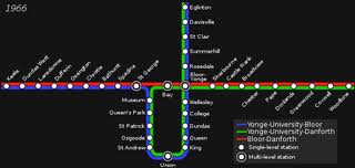
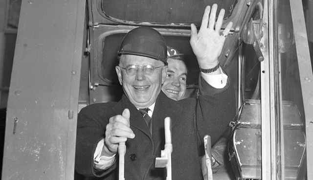
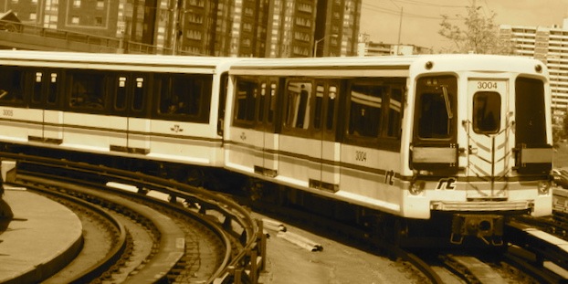
In one discussion, she bristled and became animated when I mentioned the usual received wisdom, that the East Danforth’s seemingly mysterious decline in the second half of the 20th century was likely a result of transportation changes, most notably the replacement of streetcar service with the Bloor-Danforth subway in 1966 to Woodbine, and 1968 farther east. It is an enduring theory, given legs within weeks of the subway’s opening as media latched onto attempts by the area’s “business men’s association” and locals to restore some form of street-based local transit, either streetcars or buses, that would run parallel to the subway using existing, frequently spaced stops. The group produced a 15,000-signature petition (huge numbers for a small area in the pre-social media days), but the pleas were ignored at the Toronto Transit Commission.

Jacobs said far too much weight had been given to the arrival of the subway, and called it a ‘lazy man’s theory.’ She agreed that underground subway stations – spaced much farther apart than the old streetcar stops – sped the processes that were sucking life off the street (better planning for second station entrances could have helped a bit, in her view). But she argued that commercial strips of blue-collar neighbourhoods had gone into similar declines during the same era, “all over Toronto, the continent, even the planet – and almost none of these other strips would have had new subways.”

Commercial streets, an essential component of urbanism for millennia, had, in effect, been deemed obsolete in theory and practice, and the ramifications were both far-reaching and subtle.

The larger transportation-related factors in her view were that car ownership was soaring in the post-World War II era, and that people were suddenly traveling farther to shop – to malls and bigger stores where parking was easier. People also became increasingly less likely to leave home on foot, and whole neighbourhoods and cities suffered as a result.

“Transportation matters to the discussion, to be sure,” she said. “But if you’re serious about revitalizing this street, you’ll focus on broader changes to the overall local economy, and you’ll look for adjustments to form that will naturally attract pedestrians for day-in day-out reasons.”

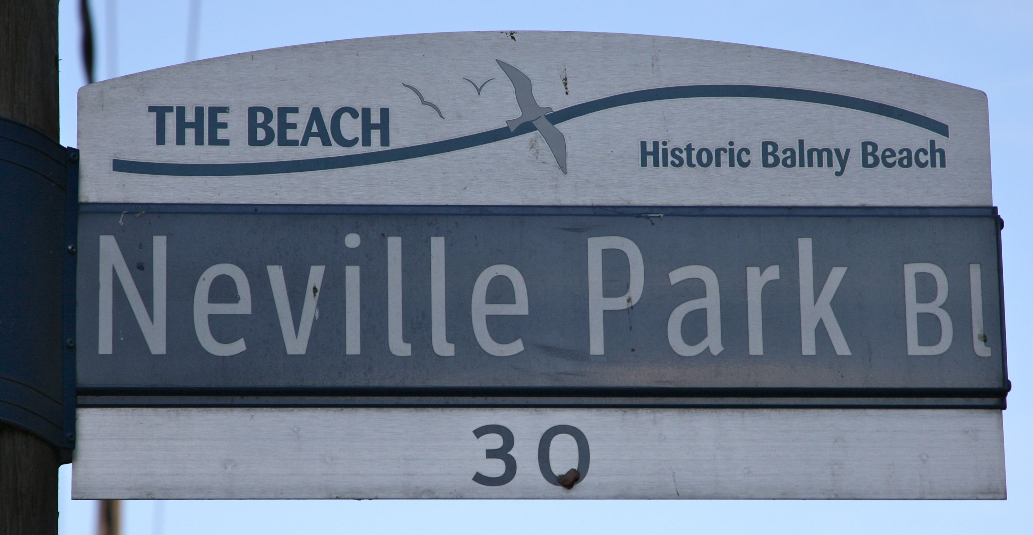
Among the things that first struck Jacobs on her walks, especially east of Pape where the nature of the street changes suddenly, was the near complete lack of Victorian or Edwardian buildings. She also found a sudden increase in the lengths of the blocks (see No. 2 in her seminal list of conditions for generating diversity).

——————————————————————————————————–

Jane Jacobs’s four conditions to generate diversity and vibrant city streets, from the The Death and Life of Great American Cities, Page 150:

  1. The district, and indeed as many of its internal parts as possible, must serve more than one primary function; preferably more than two.  These must insure the presence of people who go outdoors on different schedules and are in the place for different purposes, but who are able to use many facilities in common.
  2. Most blocks must be short; that is, streets and opportunities to turn corners must be frequent.
  3. The district must mingle buildings that vary in age and condition, including a good proportion of old ones so that they vary in the economic yield they must produce.  This mingling must be fairly close-grained.
  4. There must be a sufficiently dense concentration of people, for whatever purposes they may be there.  This includes dense concentration in the case of people who are there because of residence.

——————————————————————————————————-

She advised me to compare the block lengths east and west of Pape on a map. “Better still, walk and time them if you have the opportunity,” she said.

It turns out that most blocks on both the north and south sides of Danforth west of Pape, the much livelier Greektown neighbourhood, are no more than 100 metres and can be walked in a minute or less. Many to the east take two minutes or more. When we touched on this in a subsequent discussion she said I’d probably remember for the rest of my life that blocks in the liveliest places in cities all over the world will tend to be well under two minutes in length at my pace (see for yourself, no matter where you live or where you’re visiting). “Two-hundred and fifty or 300 feet is ideal in most cases.” (That’s 76 to 91 metres.)

But Condition No. 1 on her list, The East Danforth’s mix of primary uses, would in her view matter most to people puzzling over how to reinvigorate the area (the emphasis on the word primary was hers).  She felt strongly that if redevelopments merely added residential condos with retail on the ground floor, we wouldn’t be adding the type of mixed use that could have a major regenerative effect.  We might merely be adding to the number of empty stores, she said. And she warned that many “seemingly enlightened planners still tend to have a superficial understanding of what mixed primary use really means.”

Jacobs suggested I go to the Central Reference Library and use city directories and old maps as an introduction to the timeline of Danforth East’s development. Correctly, as it turned out, she told me to expect that the area was first developed largely in the 1920s, a point she said meant this was in fact a hybrid, not the pure streetcar suburb that some academics would label it. Private cars would have been a factor from the beginning, certainly east of Pape, even if the area had still developed largely around a main street on which streetcars arrived in 1915. She told me to look for evidence the area developed with a significant amount of employment, mostly industrial and most of it likely focused on the rail corridor to the south.

And it was there.

Prior to the area’s initial development, but well into the 20th century, lands on both sides of the East Danforth were largely operating as market gardens, providing fresh produce to the nearby city. Farming operations got larger farther north, toward the Taylor Creek valley, with several dairy operations in what was the Township of (and later the Borough of) East York, amalgamated into Toronto in 1998. Most of the area immediately north of Danforth had been Church of England reserves, known as the Glebe and usually leased to farmers. South of the Danforth (east of Greenwood and over to the town of East Toronto at Main Street), was known as Upper Midway, part of the Midway area annexed to the city in 1909. It was very rural compared with the main parts of Midway, south of the tracks, and it appeared as a virtual blank on maps as late as 1907.

Jacobs asked me to come up with a plausible explanation for the delay in development until after World War I, especially since areas farther from established Toronto had developed sooner (around the Grand Trunk/Canadian National station and yards at Main Street). I’m open to arguments, but it seems probable that the biggest delaying factor was that, east of Pape, five creeks crossed the Danforth (a.k.a. The Second Concession and later The King’s Highway No. 5). The railway tracks had also established themselves as a barrier. Though the tracks had brought the Town of East Toronto to life, the corridor barrier itself would increasingly become a drag on the area in the later 20th century, especially as it got closer to the Danforth heading east and as industry that once provided jobs in the area moved out to the suburbs.

Though the Danforth (originally the Don and Danforth Plank Road) had opened in 1851, the imposition of a concession grid, forced the street to follow a predetermined straight line, despite ravines and marshy areas that would not have been apparent in the kingdom’s Colonial Office in the 1790s. The road’s path was set decades before surveyors arrived. The Danforth was a nightmare to maintain (a job left largely to the farmers who used it and paid tolls — a source of protests and legal disputes). The rickety wooden bridges often got washed out. And even when they weren’t, travelers to the city still had to get to down to Queen, Gerrard or Winchester streets to cross the Don Valley.

Rickety wooden bridges on the east Danforth often washed out in storms. City of Toronto Archives photo

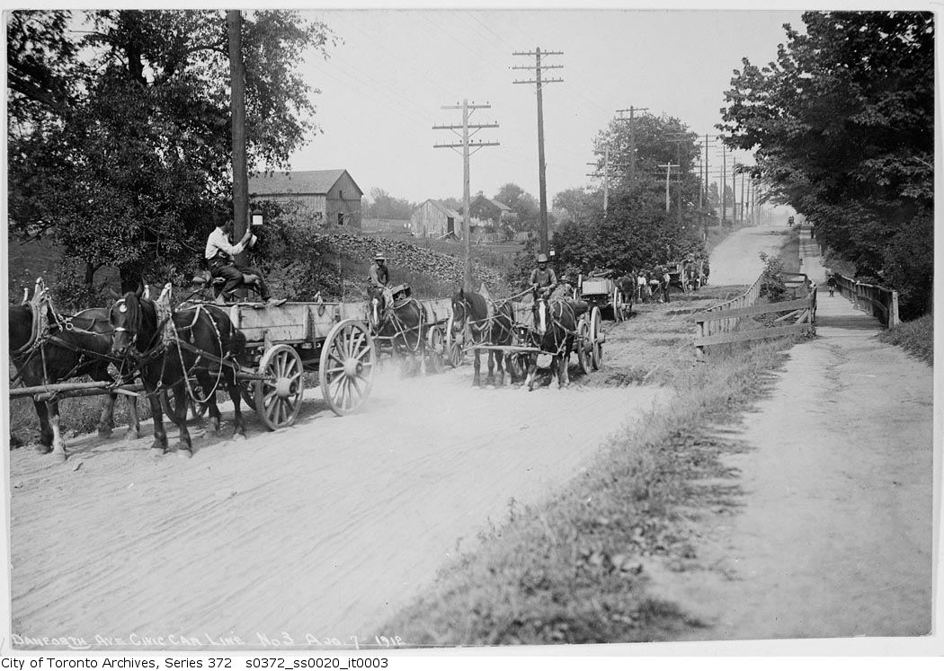
Even though streetcar service and proper paving came to the East Danforth in 1915, development didn’t happen until a housing shortage after the Great War and the opening of the Prince Edward Viaduct in 1919. Something that also held up residential development in the immediate Coxwell-Danforth area was a stench from the Harris abattoir and rendering plant, which was eventually driven away in the early 1920s (and though this is also a clear instance where employment and residential don’t work in close proximity, even the Harris plant attracted a small enclave of residents using kit housing just southwest of Danforth and Coxwell).

In the city directories, Jacobs suggested I look for trends related to the stores that sprang up: Aside from the fact that many merchants lived upstairs from their businesses, the most stunning thing was the lack of turnover. Vacancies were listed when buildings were new in the 1920s, but were almost non-existent again until the late 1950s. There was very little turnover among businesses through the Great Depression, 1940s and early ’50s, indicating a healthy local business environment despite great challenges facing the global macro-economies. Even when Woolworth moved from east of Woodbine to snuggle up next to department store rival Kresge in 1942, displaced shops found ways to stick around — some at Woolworth’s old site.

The variety of shops, especially close to Woodbine was remarkable. Though supermarkets in the 1950s were much smaller with limited offerings, there were nine of the Loblaws, A&P and Dominion variety from Greenwood to just east of Woodbine), as well as butchers, bakers and produce shops. There were also many clothing and shoe stores, and the three movie theatres would have contributed to sidewalk life in the evenings.

These were all things Jacobs expected me to find, and she said it was important to note that the turnover and vacancies started appearing well before any subway construction began, even if locals didn’t really pay attention to the strip’s decline till later. Some feared the subway would bring over-development, yet the opposite happened, and many are still astonished by the lack of development more than 50 years after the subway opened.

There is also a strong likelihood that plans for an extension of the Gardiner Expressway into Scarborough, through the neighbourhoods straddling the railway tracks, hung over the local real estate market in the 1960s and ’70s. Hundreds of homes were to be expropriated just for the interchange at Woodbine, not far south of the Danforth.

The Ford of Canada main assembly plant became Shopper's World mall after the company moved operations to Oakville. The loss of jobs and the shift of stores from the street were "a double whammy" for the neighbourhood.
The main Ford of Canada assembly plant became Shopper’s World mall after the company moved operations to Oakville in the 1950s. The loss of jobs and the shift of stores from the street were “a double whammy” for the neighbourhood. PHOTO COURTESY FORD OF CANADA

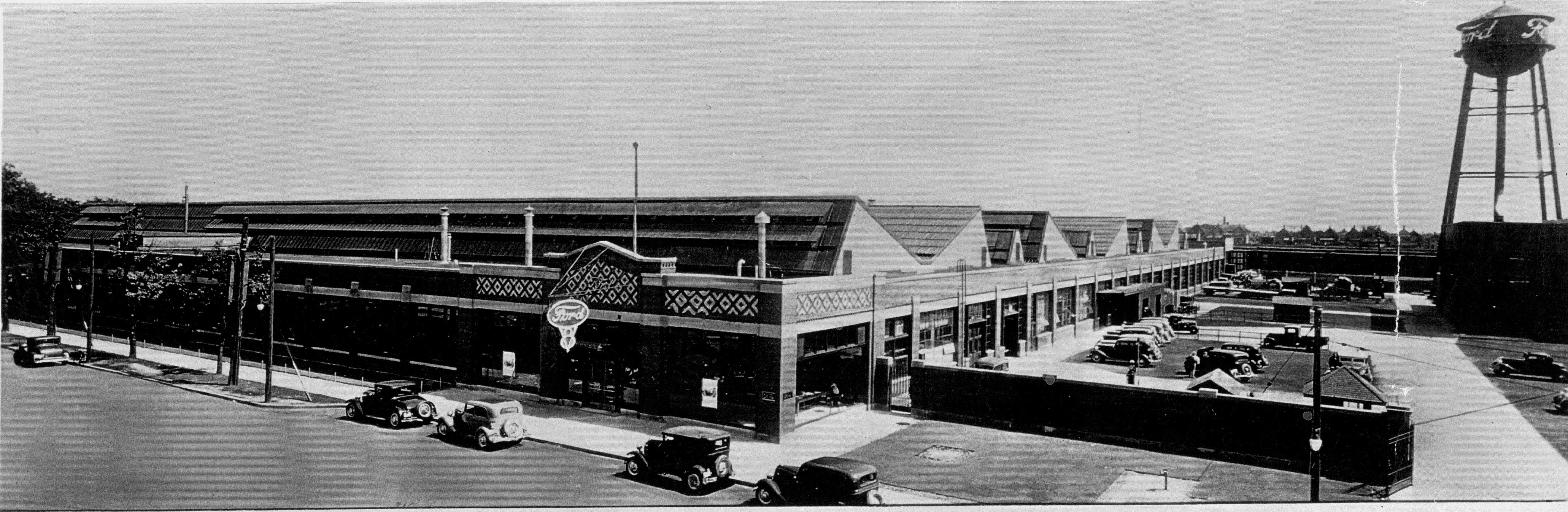
As for industry and employment, there wasn’t so much right on the Danforth itself, though it’s worth noting that Canada Bread had its main Toronto plant just east of Greenwood (and the folks at the Linsmore Tavern said the plant workers kept them very busy on breaks and shift changes). Ford of Canada, before moving to Oakville in the 1950s, had its main operations at what, in 1962, became the Shopper’s World Mall, west of Victoria Park, right by the eastern loop of the streetcar line on a small strip where East York actually reached down to the Danforth.

Jacobs called the loss of that employment and the fact that some Danforth stores moved to the mall in the early 1960s a “double whammy” for the strip. Car dealerships and the TTC streetcar barns at Coxwell (now only partly used, and mostly as parking for subway staff) also brought lots of workers to the neighbourhood or provided jobs that local residents could walk to. And, of course, lots of people working in the area provided essential daily business for local shops and restaurants. Along the rail corridor, less than a half-kilometre to the south, were major industrial enterprises, including a John Wood plant on Hanson Street, the largest source of hot water tanks in Canada from the 1920s on. Service Station Supply was an assembly plant for gas pumps and hydraulic lifts. There was a factory producing stoves, washers, ‘ice boxes’ and fridges. There were many light industrial operations as well as quarries and brickyards on either side of Greenwood.  Major suppliers of coal, lumber and other building materials were located all along the tracks from Greenwood to east of Main, where the CNR shops and freight yards began.

Jacobs wanted me to see that, while many preferred to drive out from of our neighbourhood the noise and trucks that increasingly accompanied industry, the shift to an overwhelmingly residential area quietly undercut essential facets of the local economy, including the shops and restaurants on the Danforth. The loss of industry meant the rail corridor bordering the southern parts of the neighbourhood shifted from attracting much economic activity to the East Danforth to being a barrier and a drag on the area, a hindrance to walkability and connectivity.

Late in the 20th century, even though household sizes got smaller, in pure residential terms the neighbourhood actually got denser because housing was built on former industrial land. But the mix of primary uses – usually residential and employment, with a few specialty shops or large theatres that can draw people from other parts of town – was getting badly depleted.

Looking forward, she said: “Residential density itself won’t be enough of an answer if you really want to create or recreate a vibrant neighbourhood,” she said, adding that residential density by itself, especially if it becomes high-rise, high-density could be a big problem if we don’t pay attention to all the generators of diversity.

On that count, she said the options are limited. There might be small gains to be had by breaking up some long blocks, but the new passageways or streets would almost certainly never penetrate more than a block or two into the surrounding neighbourhoods. Creating a deep inventory of buildings of different ages is a long-term organic process; the key would be to ensure that the 1915 TTC barns and much of the 1920s buildings be saved (likely not a problem with the fragmented ownership and often shallow lots). Density increases, especially right on the Danforth would be helpful, but we might need less than many think, especially if significant employment is included.

“There’s opportunity in bringing employment to sites at the subway stations,” she said (and she agreed that the TTC lands and some north-side parking at Coxwell and the Valumart parking lot at Woodbine are probably our only significant options for bringing mid-rise office buildings into the local mix. (Our discussion didn’t consider areas as far east as Main Square and Shopper’s World, but clearly, there’s redevelpment potential there).

The five-acre TTC lands at Danforth and Coxwell were used as a bus garage when Jane Jacobs studied the strip. These days much of the site is used, ironically, to provide free parking to transit workers.
The five-acre TTC lands at Coxwell were used as a bus garage when Jane Jacobs studied the strip. These days much of the site is used, ironically, to provide free parking to transit workers. Shockingly for many, it’s larger than the Honest Ed’s site set for redevelopment.

She added that we were lucky to be approaching things at this time (she was speaking in 2004) because much of the GTA’s employment gains are likely to be in office work, and that even just a few mid-rise office buildings near the stations might bring enough workers to help “rebalance the local economy.”

Though she died in early 2006, Jacobs lived long enough to see a resurgence of life  downtown when usage restrictions were lifted on “The Kings,” and when a new wave of residential development was able to complement the dense employment zones, allowing secondary-use shops and services to come back in the core. She saw it as encouraging.

Returning employment to the Danforth area could, in her view, have a similar effect (though on a much smaller scale) by getting more people out onto the sidewalks for different reasons at different times of the day, helping lots of small shops and restaurants to “get over the hump … it often takes just a handful of extra customers a day to make a difference in small-scale retail.”

She emphasized that year-round walkability relies heavily on people having regular economic reasons to be out on the local sidewalks. “You won’t get industry again, and few would tolerate it, but office work and some new residential density right on the Danforth could be great for the city and your area.” She felt the Avenues focus in the city’s Official Plan could be life-giving for the East Danforth.

She also noted that the Danforth has spare subway capacity in what transportation people call the ‘contra-flow,’ – half-full trains going in the opposite direction of the main rush-hour crowds. She called that “untapped potential.” She remembered surface parking near some of the subway stations and called that  “a waste of potential.”

“This may come as a surprise to you,” she said, “but part of the area’s empty-store problem is that there’s too much retail space for the current size and makeup of the local economy. Most of that retail is going to be secondary-use stuff.”

Demand for the retail space on a strip such as the Danforth, in her view, was very much a reflection of the health and diversity (or lack thereof) in the wider local economy. It’s almost certain that she would have been a huge supporter of DECA’s pop-up shop program. She  said: “Vacant storefronts certainly feed vicious cycles of decline, but if you’re smart, long-term, you’ll view them (and street crime) as mere symptoms of bigger problems.”

Anyway, it’s a gorgeous September day and signs of new life have been popping up on the East Danforth for nearly a decade now. Even though the writer’s block isn’t necessarily holding me back, I think I’ll go for a walk.

————————————————————————————————-

Stephen Wickens is a journalist and a former board member of Danforth East Community Association. At present he leads DECA’s Visioning committee. Much of the material gathered from talks with Jane Jacobs (directly and indirectly) forms the basis of an annual Jane’s Walk, ‘The Death and Life of Upper Midway.’


Categories
East End Toronto Frivolities

Once and for all, is it Beach or Beaches?

beaches

A slightly abbreviated version of this story ran on Feb. 4, 2006, in The Globe and Mail. Singularists prevailed in the online poll weeks later, the new street signs were installed without protest and the Beaches BIA changed its name to The Beach BIA. Sandra Bussin was defeated as city councillor in 2010 and Glenn Cochrane died in June 2012. I was raised in the area but won’t have a firm opinion until I see better evidence.

By STEPHEN WICKENS

Toronto’s budgetary shortfall looks impossible, there’s no end in sight for gun violence or poverty, and no imminent start dates for long-discussed waterfront and transit proposals.

So maybe we should have known it was too good to be true when word leaked out of old Toronto’s east end last month that the seemingly interminable and sometimes nasty Beach vs. Beaches fight was finally over.NEVILLE.sign

“It’s going to be ‘the Beach’ — not ‘the Beaches,'” Neil Macdonald said with conviction on Monday about the wording of new street signs planned for the lampposts of Queen Street East between Lockwood Road and Neville Park Boulevard this summer.

“Personally, historically, I think it’s more accurate to call this ‘the Beaches,’ but this time we’re taking the path of least resistance,” said Mr. Macdonald, chairman of the Beaches Business Improvement Area. “The [Beach] singular crowd are the most militant, while the ones who call it ‘the Beaches’ don’t seem to care too much.”

Maybe Mr. Macdonald underestimated the passion of the pluralists — by Thursday, the BIA’s landmark decision was rescinded and the odds of peace in our time appeared as slim as ever. If anything, the war is in danger of serious escalation in the coming weeks as the BIA prepares its website for a little community consultation.

“Well, here we go again,” former CFTO-TV reporter and long-time Beacher Glenn Cochrane said with a loud laugh when told that Mr. Macdonald believes that the impending cyber-battle will provide “a definitive one or the other, a final choice” — maybe within a month.

As far as anyone can tell, Beach/Beaches hostilities go back at least 50 years, and in that time neither side has produced the arsenal of evidence needed to settle matters once and for all. Hard-line Beach types have long tolerated names such as the Beaches Lions and the Beaches Library (where it’s Beaches in stone on the 1916 branch building). They have also embraced the Beaches International Jazz Festival, and haven’t been overly vocal about the relatively recent naming of the political riding, Beaches-East York.

Street signs are something else.

Locals on both sides of the issue haven’t forgotten August 1985, when blue and white signs proclaiming “The Beaches” appeared between Hammersmith and Bellefair Avenues. Anger erupted within hours, but it took until October for the Beach faction to get the city to remove them.

“It was ugly,” said Gene Domagala, who was on the city’s historical board at the time. “I was called in by the mayor [Art Eggleton] along with both city councillors [the late-Dorothy Thomas and Tom Jakobek].

“The media got involved. There were hundreds of letters. A lot of people turned nasty,” Mr. Domagala remembered. “The old-timers said only outsiders and newcomers would ever say ‘the Beaches.’ They were livid that the Queen Street businessmen [who were behind the initiative] hadn’t consulted residents.”

Mr. Domagala, a fount of local historical knowledge, tends to say “the Beach” in casual conversation, but he doesn’t try to tell others what to say. He liked the decision that the BIA has now rescinded, but said, “We’ll never placate everyone.”

At the height of the battle in 1985, long-time resident Mary Campbell told a Toronto newspaper that even though many people say the Beaches, “It’s always been the Beach . . . This [the Beaches signs] only feeds the error.”

Ms. Campbell, whose views haven’t changed, is president of the local historical society. She says her parents, who came to the area before the 1920s, always said “the Beach.” Early in the week she was pleased upon learning the BIA plan: “The Beach” at the top of the new signs with a designation on the bottom of each for one of the area’s four beaches — Balmy, Scarboro, Kew and Woodbine.

But she’s upset with the new BIA plan not because she’s against choice or consultation, but because she thinks a Web poll will be unfair.

animal“I don’t have Internet, and that’s probably true for other older people who know the truth,” Ms. Campbell said. “Maybe it’s time to organize and find out who else won’t take this lying down,” she said, adding that a possibly acceptable compromise would be Queen Street signs for the Balmy, Scarboro, Kew and Woodbine beaches that drop “the Beach” and “the Beaches” altogether.

Of course, the fact the area once had four distinct beaches is used by pluralists to argue that “the Beach” is an illogical term. They also say that “the Beaches” has a long history of common usage. Singularists counter that “the Beach” is just as logical because it has been one community since the four neighbourhoods merged.

And round it goes.

Mr. Cochrane doesn’t take sides, but he correctly predicted early in the week that the BIA would find it had foolishly jumped the gun by not consulting residents first.

“There could be a severe chastising this time too,” said Mr. Cochrane, who moved to the area 40 years ago and writes a column called Beach(es) Beat for a local weekly. He doesn’t think a similarly diplomatic use of parentheses would work on street signs.

He also sees danger in consultation because Beachers can’t agree on neighbourhood boundaries. “Will someone’s opinion count if they live north of Kingston Road? Real estate agents have long had a very flexible view of what they can sell as the Beach.”

There are two things that nearly everybody in the area can agree on: The older the Beacher the more likely he is to be a singularist, and that the views tend to be passed down through families. And an informal poll taken this week outside two neighbourhood institutions — the Garden Gate restaurant and the Beaches Library — showed both sides fairly evenly split. When asked which name they prefer, 24 residents said “the Beaches,” 19 said “the Beach,” while four were undecided and two abstained.

One of the abstainers noted that he has lived in the area since the 1930s and hates the Beach/Beaches debate because it always turns to pejorative talk about outsiders and newcomers. He said that in his youth, it was Catholic-hating Orange Lodge members who insisted on Beach rather than Beaches.

So perhaps a compromise is in order: Might alternating Beach and Beaches on every other post work?

beachNot in the opinion of the local city councillor, Sandra Bussin, who also refuses to state her preference. Ms. Bussin, who says she doesn’t believe a Beach/Beaches battle will become an election issue, said the citywide replacement program in the area is on hold until matters are settled.

Mr. Macdonald says it will now be fall at the earliest before new signs — however they are labelled — are up.

Meanwhile, some Beachers, like Hugh Cooper, just can’t take the debate seriously.

“The Beach? Wasn’t that Kramer’s cologne on Seinfeld?” he asks with a laugh. “It would be just like this neighbourhood to have it out again. It’s a great place to live, but it would be better if people took stuff like litter more seriously, or if they put their energy into helping seniors or Cubs and Brownies.”

Categories
East End Toronto Toronto Transit Uncategorized Urbanism

TAO and the politics of transit ideas in Ontario

Backers of an electrified GO-based Scarborough Rapid Transit replacement plan  may be a test for Rob Prichard’s assertion that it’s never too late for good ideas

Metrolinx chair Rob Prichard answers a reporter's question after the Sept. 10 board meeting, while president Bruce McCuaig looks on.
Metrolinx chair Rob Prichard answers a reporter’s question after the Sept. 10 board meeting, while president Bruce McCuaig looks on. Prichard indicated that he and the folks at Metrolinx view the transportation minister’s stripped-down subway idea as “fresh thinking.”

“Usually, the thing that’s in shortest supply in life is good ideas,” Rob Prichard told reporters after the Metrolinx’s Sept. 10 board meeting.

“When a new idea comes into play, our job is to take it seriously, do due diligence and see if it works,” the the transit agency’s chair said, apparently under the impression that Glen Murray’s Scarborough subway idea qualifies as fresh thinking.

“It’s never too late for great ideas.”

Well, those words may soon be put the test.

Folks at Transport Action Ontario, a respected transit activist group, believe they have the great idea for the Scarborough rapid transit replacement project as part of their Regional Rapid Rail Report, released last month.

Even if it’s only a good idea, it appears to have major advantages over the two subway proposals transit bureaucrats have been forced to take seriously in recent weeks. It also appears to have a significant edge over the light-rail plan that would divert the Eglinton Transit City line up to the Scarborough Town Centre, as per the much-vaunted Master Agreement ™ between Metrolinx and the city.

The biggest question is, will those in power seriously consider the idea in time?

The good news for TAO is that their report is on Metrolinx’s radar, though Prichard seemed surprised when it was mentioned in relation to the Scarborough situation – an hour or so earlier, during the seemingly scripted part of the Metrolinx meeting, he sought assurance from one of his VPs that TAO’s report would be considered as part of a Downtown Relief Line study.

In a nutshell, TAO sees the GO rail network as badly under-utilized in a metropolitan area desperately short of time, funding and transit infrastructure. TAO figures if we seriously speed up Metrolinx’s long-range plan to electrify GO’s network, we can get subway-quality service akin the S-Bahns of Germany for $55-million a kilometre – that’s less than LRT.

Key to the plan would be electric multiple-unit trains, which would be bi-level like current GO rolling stock, but would have traction motors in every other car. Rather than use a third rail, these EMUs draw current from overhead wires. According to Karl Junkin, the main author of the TAO report, EMU trains would be cheaper to run than ones hauled by diesel locomotives, with estimated savings of nearly $500-million a year. EMUs can also accelerate and brake like subways, allowing for a near doubling of the number of GO stations without slowing overall travel times. In combination with frequent service, this is massive in that it doubles the number areas where people can walk to a station and multiplies the number periods in which the stations are useful. That in turn can seriously improve efficiencies for transit operators all across the region.

“We’re talking trains every four minutes during the rush hour and every 15 minutes off peak,” Junkin says.

TAO argues the EMUs would provide faster service from downtown to Kennedy, Scarborough and beyond than either of the subway options – a city/TTC proposal for Eglinton and McCowan up to Sheppard for $2.3-billion (plus or minus 30 per cent), and Transportation Minister Glen Murray’s two-stop idea that would largely follow the current SRT corridor. Also, instead of adding ridership to the Bloor-Danforth, which is already at capacity in the morning rush, TAO’s EMU line would actually divert customers – acting as a sort of Downtown and Bloor-Danforth Relief Line.

“I have to emphasize that our plan would not eliminate the need for a DRL, Junkin says. “Not even close, but it buys us time, especially on the Richmond Hill and Scarborough corridors.”

Another potential advantage TAO’s idea has over the Murray plan, and the LRT proposed for the SRT corridor, is that the shutdown period could be shorter than three years, and the shuttle bus service needed during construction would only have to be from STC to Ellesmere, rather than STC to Warden or Kennedy stations.

In creative societies – a concept championed by Richard Florida and former premier Dalton McGuinty – rare good ideas are deemed valuable and creative people are encouraged to get them into circulation. But getting good or even great transit ideas “into play” in this province is nearly impossible if you’re not a well-placed politician. Even our transit agencies are taking their cues from politicians and seem shy about using their many talented people to truly seek and suggest best alternatives.

Prichard tells us Metrolinx will be unbiased in carrying out “confirmatory studies” of Murray’s plan. The provincial agency that was to depoliticize the transit planning process is clearly fixated on a corridor that has failed to produce transit-oriented development or urbanism despite nearly three decades of extremely costly rapid transit service. Those who’ve followed the Scarborough saga for decades can tell you the corridor wasn’t anybody’s first choice 35 years ago, but because it has been a default part of so many plans over the years, it now seems to have been accorded some kind of precedent status.

The TTC, meanwhile, also seems as beholden to politicians who are supposed to oversee the commission, a perversion of the intent when the board was reconstituted about 20 years ago. When asked if the TTC is even considering other options, WorldWideWickens was told the mandate is to study the two options that politicians have suggested. That’s reminds us of quip from Richard Soberman, one of the deans of the local transportation advisory business: “Getting advice from politicians on transit makes as much sense as going to the dentist for a colonoscopy.”

Anyway, it will astonish many, including a few within TTC HQ, but according to Andy Byford’s column in Metro on Sept. 13, the Eglinton-McCowan routing is “supported by myself and TTC staff.”

Soberman, by the way isn’t totally enamored with TAO’s plan. He says Junkin should have taken a more demand-oriented approach and he thinks the technical feasibility and cost estimates are “very optimistic.” Ed Levy, another of the wise local transit elders and author of Transit in Toronto, A Century of Plans, Progress, Politics and Paralysis, has written an endorsement that appears on the home page for TAO’s 400-page opus.

For what it’s worth, I had been supporting a subway plan that appears to be much better than either of the two on the table, but TAO’s report won me over in early August.

Merit aside, Junkin and senior TAO people know there will be resistance to any new proposals that appear to clutter an either-or subway race. They know they need a political champion to put their idea “into play,” to use Prichard’s terminology. TAO people have been meeting with senior planners and politicians throughout the region in recent weeks, and I caught up with them at City Hall on Thursday, during a meeting with Ward 32 Councillor Mary-Margaret McMahon.

TAO report author Karl Junkin discusses the GO electrification proposal with Ward 32 Councillor Mary Margaret McMahon during a presentation at City Hall.
TAO report author Karl Junkin discusses the GO Regional Rapid Rail proposal with Ward 32 Councillor Mary Margaret McMahon during a presentation at City Hall.

Not that seniority is likely to help, but it’s worth noting that TAO’s plan actually came out before the July City Council meeting at which the expensive Eglinton-McCowan subway option was approved (It seems to still be under the radar for most politicians despite a good story about by the Star’s transportation reporter Tess Kalinowski). Murray’s suggestion, meanwhile, which most figure has the inside track, apparently wasn’t even a germ until after council voted for a subway less than two months ago.

“This project is about a region-wide network, but the whole Scarborough debate has suddenly made things urgent,” TAO president Peter Miasek admits. “But I think a lot of people are going to be angry down the road if politicians overlook what is clearly the best overall option for all concerned.”

These guys pray Prichard is right about one thing, that it’s never too late for great ideas.

Categories
East End Toronto Toronto Transit Uncategorized Urbanism

Ten Years To Retrofit The SRT For A Scarborough Subway?

Instead of funding, premier Leslie Frost arrived at the November 1959 ground-breaking ceremony with only a red hard hat and a speech warning local politicians not to go too far into debt for their ambitious University-Bloor-Danforth subway project.
Instead of providing any funding, Premier Leslie Frost arrived at the November 1959 ground-breaking ceremony with only a red hard hat and a speech warning local politicians not to go too far into debt for their ambitious Bloor-Danforth-University subway project. Torontonians went ahead anyway and got digging. (Toronto Telegram fonds ASCO7444)

By STEPHEN WICKENS

So, according to the Star on Friday consultants who are undoubtedly well-paid by you and me have told Metrolinx it will take 10 years to retrofit the Scarborough Rapid Transit line for the province’s Kennedy-to-Scarborough Center subway extension. Maybe that makes sense in a town where it takes a good four years to renovate Pape station.

When I read pieces like these, I think of the Torontonians from that post-Second-World-War generation. Yes, bigotry, provincialism, second-hand smoke and reluctance to party were among the notable but often cliched downsides to Blue Law Hogtown. But Toronto was a hive of energy, optimism and overall levels of goodness to easily match our often smug cosmopolitanism.

Like us, those Torontonians squabbled over subways. They couldn’t even settle on Bloor versus Queen until January 1958.  But even though our city was a much smaller and poorer place, those Torontonians weren’t going to use the province’s refusal to kick in any funding as an excuse to procrastinate.

In 2013 we’re told it will take five years just to plan this SRT retrofit.

For some reason, our old-school slide-rule engineers were much more efficient than their latter-day counterparts and their technology. Maybe they had better bosses and were freer to do their jobs.

Shovels had already hit the ground by November 1959 on what was known as the Bloor-Danforth-University Subway Project. A little more than six years later — despite having problems with soil conditions, underground streams and dense urban webs of unmapped utility infrastructure to relocate or work around — the whole thing, from Union to St. George and Woodbine to Keele, 25 stations and more than 16 kilometres, was up and running.

bloordanforth

The project also made it within the $200-million budget.

You could even claim they got the Bloor-Danforth open a couple of years early, but that’s because the province finally consented to guarantee Metro’s loans.

Then the Torontonians celebrated their victory by hauling the giant hollow horse into the city … or or something like that.

PS: Despite the sometimes flippant tone of this post, we recognize and honour the sacrifices of John Blaney, Edgar Ostkamp, Albert Low, Rosaire Beaudry, Lauri Karkas, Tommy Kerr, Attilio Tricinci, Frank LaPlante and Larry Linyck. All nine lost their lives during construction of the Bloor-Danforth subway.

PPS: The Leslie Frost photo was taken by the Telegram’s Peter Ward and is published courtesy of York University Libraries, Clara Thomas Archives & Special Collections.

Categories
East End Toronto Toronto Transit Uncategorized Urbanism

More Scarborough Transit Indignity

kennedy_rt8

Few will mourn the unreliable orphan foisted on us by provincial bureaucrats who claimed ICTS technology would be a low-cost alternative to subways. But it turns out the troubled RT didn’t just cost more than light rail, it almost certainly cost us more than a subway would have in the first place.

By STEPHEN WICKENS

If there’s a heaven, and if Gus Harris gained entry, you can bet he’s put the harp lessons on hold to follow the Scarborough transit fiasco.

Harris, Scarborough’s mayor for much of the 1980s, opposed the once-futuristic Intermediate Capacity Transit System (ICTS), designed to be a low-cost alternative to traditional subways, which were proving too expensive for suburban applications (at least in the absence of real world-class land-value-capture systems).

In 1981, when Scarborough council snubbed Harris to back a switch from conventional light rail to the province’s unproven technology, he dubbed it “The Toonerville Trolley.” When Metro council finalized the switch weeks later, he said, “I don’t think Scarborough should be guinea pigs for this.”

Minister of transportation James Snow and Kirk Foley, head of the province’s Urban Transit Development Corp., had led Queen’s Park’s hard sell that spring. Future mayor Joyce Trimmer led the majority Scarborough council faction. They were feted by UTDC and flown to Kingston to see it on a test track. They quickly bought in on a promise that ICTS would be a huge step up from the then-new streetcars that had been expected to ply the Kennedy-Scarborough Centre corridor as per a 1977 plan approved by Metro Council.

ICTS was to cost $134-million, 24 per cent more than the streetcar option, whose estimate had risen to $108-million by 1981. But Cabinet at Queen’s Park, eager for a working line to showcase UTDC’s driverless ICTS trains to the world, vowed to pick up all extra costs.

So what could possibly go wrong?

A year later, the TTC – a diplomatically reluctant partner in the ICTS plan – announced costs had soared to $181-million. Minutes of an internal meeting available at the archives show the bad news was known months earlier and that the eventual announcement played down the escalation estimates, which had actually reached $193-million.

NEW

To the odd person, me, who remembered the subway extensions from Islington to Kipling and Warden to Kennedy had opened in 1980, under budget at a combined cost of $127-million, even the low-balled $181-million RT tab raised red flags.

Might a subway cost less?

It was a simpler time. I simply phoned the main TTC number and was put straight through to a man named Stan Lawrence, who was heading up the RT project. He was friendly when asked if a subway option had been considered. Of course it had, he said, adding that costs and potential alignments had been studied and that the determination was that the best subway would cost slightly more than twice as much as the streetcar option (estimated at $68-million in 1977, likely the last year a subway estimate would have been calculated). When I asked for a specific subway cost and to see the studies, he shut the conversation down, saying the report wouldn’t be made public because only light-rail and the ICTS plan were on the table.

I then called Mayor Harris’s office, and he got back to me about a week later.  I told him if Scarborough’s downtown dream was to ever become reality, it probably needed a single-seat connection to Toronto’s core some day. It seemed this was a natural one-technology subway corridor extension of the Bloor-Danforth that shouldn’t be broken up for ICTS or streetcars. (I’ve always liked what light rail can do and I had no problem with a UTDC demonstration line, as long as it went into a fresh corridor elsewhere.)

The original Scarborough light-rail proposal used the old Canadian Northern Orono subdivision (a plan killed when it ran into opposition that could literally be called Not In My Back Yard). There's a strong chance the original  and relatively inexpensive subway idea also used this route, though we'll never know without the lost report.
The original Scarborough light-rail proposal used the old Canadian Northern Orono subdivision (a plan killed when it ran into opposition that could literally be called Not In My Back Yard). There’s a strong chance the original and relatively inexpensive subway idea also used this route and its Pythagorean directness, though we’ll never know without the lost report.  MAP COMES FROM STEVE MUNRO’S FILES

Harris made clear it was too late to for changes. The Scarborough city council and Metro had made their decisions; the province had taken charge of the file and was footing the bill. There would be no turning back, though Harris, who had backed light-rail all along, suddenly sounded keen to know what a subway would have cost.

Weeks later, Harris called and suggested we go for coffee. He didn’t have much more to say than that he’d been talking with TTC engineering staff who told him a subway extension from Kennedy to Scarborough Centre had indeed been studied and that the cost estimate was between $150-million and $175-million. He also said that some day, “maybe in five, 10 or 20 years, we’ll get to say I told you so.”

SRT problems made frequent headlines in the early years of operation and costs eventually topped $220-million as major modifications were needed. Internally, TTC staff had joked that ICTS stood for, It Can’t Traverse Snow. Harris called it “Lada transit at limo prices,” when I ran into him on Queen Street one day.

In 1989, Harris, no longer Scarborough’s mayor, phoned me with a scoop that there was a serious behind-the-scenes push at the TTC and Metro to scrap the SRT just five years after it opened. Queen’s Park had heard about it and was leaning on politicians and staff to shut up because UTDC had pending sales in Asia. (Neither Asian deal panned out, and the Star’s Peter Howell got the scoop because I was working at a national business paper uninterested in Toronto transit stories.)

It’s total coincidence but highly appropriate that I was reading Barbara Tuchman’s March of Folly on my first SRT ride in the spring of 1985. The sound of the surprisingly noisy vehicles also left an impression.

A few weeks after that initial SRT ride, the TTC and the city released an ambitious rapid transit expansion plan called Network 2011, calling for a Downtown Relief Line and subways on Eglinton and Sheppard. Shortly thereafter, I got to discuss Network 2011 with a senior TTC man, who told me very interesting stuff after he got me to promise that our talk was all off the record. This was, at most, three months after the SRT opened, and he said firmly the TTC would never consider ICTS again. Also of note was that the DRL was the TTC’s clear priority, even if the official story, for political reasons, was that Sheppard should come first.

As for Gus Harris’s $150-million to $175-million estimate for a subway from Kennedy to Scarborough Centre, he said those numbers were accurate, confirming that the province’s low-cost alternative almost certainly cost more than a  subway would have in the first place – a particularly galling thought now that it’s near the end of its life just three decades later.

When I suggested the cost-comparison might be the reason for the TTC’s reluctance to release its work on the subway option, he said, again with a warning this was off the record, that the SRT cost was Queen’s Park’s embarrassment. The TTC was probably more worried about public reaction to the fact that extending the subway cost-effectively would require mothballing Kennedy station, which was then just five years old.

Anyway, during the summer of 2013, as the Scarborough debate took bizarre twists, friendly staff at the TTC and City Archives tried, without success, to help me track down that never-released document, probably more than 35 years old, assessing the subway option. Maybe the fact it was never released made it okay to file it by way of a shredder.

I’m dying to see it, in part because there’s a far better alignment than any of the subway options that have been under consideration. There’s a significant chance the TTC had found that better way decades ago.

So, we’re still digging, and the Toonerville Trolley rolls on … for now.

NEWEST

Categories
East End Toronto Toronto Transit Uncategorized Urbanism

Why Ignore Our Best Scarborough Transit Options?

It should distress everyone in Ontario that the only two official options on Toronto city council’s menu – the Eglinton-based LRT/SRT replacement and a strange, three-station preliminary subway plan – are third rate, at best

For more than three decades, the swaths of land at Kennedy station have provided little return to its owners, the public. But with the Rail + Property model, we could maximize the worth of this real estate, make transit operations more efficient and take profits to reinvest in infrastructure.

(This post was written before the Sept. 4 news that the province has another idea for building this Scarborough subway. Queen’s Park’s latest idea would be fifth best among options considered below.)

By STEPHEN WICKENS

Among the emails awaiting me after a recent offline break in the north woods were requests from some of the usual suspects for my take on the Scarborough transit saga.

For a change, I’ll admit the plan I’d favoured just weeks ago is probably now second best – a realization I hit upon while studying a report by Transport Action Ontario analyzing the GO rail system’s potential – if electrification is tackled promptly and intelligently. Released in July, it’s must reading for all who care about the GTA’s economic health and quality of life.

We’ll examine the 400-page report, titled GTHA Regional Rapid Rail: A Vision For The Future, in a separate post, but we should note here that it makes a strong case for electric-mulitple-unit technology, which among many possibilities, could quickly deliver near-subway-level service from downtown, through Kennedy station to Scarborough Town Centre, Malvern and beyond for less than Metrolinx’s allegedly funded LRT option. Too bad TAO’s report didn’t appear sooner because, as important as many of the recommendations are, they likely can’t become part of mainstream discussion in time. Through the grapevine, we hear some GTA planners and decision-makers are suddenly intrigued by this report but, so far, the Star has been the only major media outlet to clue in.

Anyway, we’re talking Scarborough transit here, and as humbling as it is that my idea – an alternate subway alignment with emphasis on the Rail + Property funding model – might now be second best, it should distress everyone that the only two official options on city council’s menu – the Eglinton-based LRT/SRT replacement and a strange, three-station preliminary subway plan – are no better than third rate.

In this part of the world, we have a history of making bad transit decisions, sometimes because we cling to any ideas that have traction, fearing that if we step back and think for a moment we mightn’t get anything done at all. But dumb decisions are among the things that have killed the public’s will to properly fund transit in recent decades. The RT may be Exhibit A. It’s bad enough that we have to junk a transit line that’s not even 30 years old. Really galling, however, is the significant likelihood we spent more on this politically driven, allegedly low-cost alternative to subway than we would have spent on an actual subway in the first place – and all the while we did not realizing the RT would be temporary.

More obvious to some of us in the early 1980s, was that any serious transit line linking STC with central Toronto via Kennedy station was a natural extension of the Bloor-Danforth and that forcing an en route transfer – especially with Kennedy station lacking any destination qualities – was foolish. In 2013, it’s still a bad idea to build in a transfer for riders going into town via Danforth and Bloor, no matter how much more convenient it may be than the current station setup and no matter how much we’re concerned that the westbound Bloor-Danforth is now at capacity in the morning rush. Encouraging more city-bound Scarborough, Durham and eastern York Region riders to use Eglinton and the already overcrowded Yonge line makes no sense at all. If you consider that an Environmental Assessement is already approved for extending the Eglinton LRT east to Kingston Road and out to Morningside Mall, it’s a bad idea to divert this line to serve northeast Scarborough. Eglinton was one part of Transit City that made sense, on nearly all counts.

As for city council’s now-favoured $2.3-billion subway option, which would provide that all-desirable one-seat service from downtown to the STC (when seats are available), the preliminary alignment, apparent funding assumptions, station spacing and the lack of regard for capitalizing on surrounding real estate are all horrible. The silos that promote or tolerate this kind of “thinking” must be smashed. The only planners who could seriously consider deep-bore tunneling east under Eglinton and north under a dead stretch of McCowan – with three more wasteful standalone stations – are yes-men or yes-women working under duress.

The only comparative benefit of the Scarborough subway plan that was before city council last month is that it would allow the SRT to continue operating while the new rapid transit is built. That’s a tiny gain for the huge amounts of waste that model would entail – at a time when transit funding is scarce. Transportation minister Glen Murray said Aug. 28 that a more firm route preference will be revealed in a few weeks. Let’s hope the powers that be come to their senses in the interim.

If we are going to build a Bloor-Danforth extension to the STC, let’s seize upon it as the long-awaited golden opportunity to demonstrate the worth of the Rail + Property (R+P) business model on this continent. It can deliver far more than big savings on a one-off transit project. R+P is the international gold standard, the model best practice for subway development that proactively links transit and land-use for economic and urban planning objectives.

For some reason, decision-makers in these parts seem hostile to R+P, which has been essential to making transit funding sustainable in Far East metropolises and has kept MTR Corp. in Hong Kong profitable for decades. Adaptation and experimentation will be required for a GTA context, but the Scarborough case presents a special opportunity because the public owns so much underutilized land in the best subway corridor.

R+P considers stations as mixed-use profit centres integrated into their surroundings, while the Toronto model treats stations as cost centres, delivering wasteful standalone buildings that repel development. Don’t confuse R+P with the Ford brothers’ dreams of free private sector subways, or with the narrow and superficial consideration of value capture contained in reports from our transit funding discussions earlier this year.

There’s no way of honestly estimating how much profit potential is available – short or long term – by employing the R+P model to real estate on this route. But then the official $2.3-billion subway extension estimate being bandied about is also vague, and necessarily so. It’s a plus-or-minus 30% number, meaning anything from $1.6-billion to $3-billion (which makes this side spat with the province over $400-million seem absurd).

If R+P is considered from the start, we’d unshackle the thought process. We consider the seemingly radical demolition of the current Kennedy station, which real estate experts agree is a major impediment to transit-oriented development in such a key, potentially urban location – where the Bloor-Danforth subway, GO rail and the Eglinton LRT will meet. The focus needs to be broadened from building a transit facility at Kennedy to fully leveraging our massive publicly owned land holdings surrounding and above the station, through Build Toronto or a new but similar entity.

R+P would require a cultural adjustment for Torontonians. Rather than decrying the unearned value granted lucky or well-connected landholders in station catchment areas, we, the people, would be in position to profit and reinvest. We own that land and should be demanding that our politicians do all they can to maximize returns from our assets and infrastructure investments. Long term, the example of efficiency would also likely nurture the political will to fund transit properly, and that’s important because R+P cannot come close to doing it alone in the North American context.

R+P for the Scarborough extension might also be a great opportunity for a provincial government trying to revive its image after the gas-plants scandal. And if the province were really smart, it would create a Build Toronto-like Crown corporation to bring in private-sector expertise for maximizing the worth of lands surrounding our GO stations. Metrolinx has quite the portfolio of underutilized land.

Making the Scarborough subway extension work economically would require adjusting the alignment through a new Kennedy station and briefly into the old SRT space before turning into the main Gatineau hydro corridor, at least to Brimley and Lawrence. That would allow us to use much-less-expensive cut-and-cover tunneling (and don’t forget that cut and cover was and is plenty good for most of the original Yonge, University and Bloor-Danforth subways). It would mean a bit more traffic disruption during construction, but if it significantly increases the chances that Scarborough residents get their subway – and get a more useful subway with more stations at a better price – it will be tolerated. Brimley is also quite dead, but it is better suited to subway than McCowan, and would allow us to reach the STC via the west side with less underground work.

Burying high-voltage wires and removing the towers while digging cut-and-cover subway tunnels can open up huge amounts of valuable real estate at station sites, such as this spot here where the Gatineau hydro corridor crosses Midland.

Better still, with hydro infrastructure buried in the Gatineau corridor during tunnel construction – a surprisingly inexpensive process – stations at Midland and at Brimley-Lawrence could be designed as the hearts transit villages on newly freed-up lands. The hydro corridor acreage is huge and we would have to get the province to transfer the lands from Hydro One to Build Toronto. But if we blend in office, residential, retail, educational and service uses, and if we focus on the pedestrian, we’d ensure subway-worthy ridership before the long-term and obviate the need for high-rises.

Even where we don’t own the land, at Scarborough Town Centre, R+P can come into play as Oxford Properties should find it worthwhile to provide a station  as part of the basement/foundation of new developments. Where R+P is used, it’s understood the marginal cost of station infrastructure tends to be much less than the upstairs premium available to the developer if the excavation, foundation and platform work is done at once.

Alas, while I love this second-best plan because it can get us past the absurd idea that Toronto cannot afford subways, it would increase Bloor-Danforth line ridership, which is a problem with all the Scarborough rapid-transit options other than the one presented in the TAO report. It’s sad, but as Toronto Transit Commission CEO Andy Byford and transit planning veteran Ed Levy point out, we’re short of good network options because the Downtown Relief Line is so overdue for the entire region.

I hold out little hope that the transit bureaucracies and politicians will wake up to the possibilities in time, and that’s a shame. This is a rare and special opportunity.


Categories
East End Toronto Uncategorized Urbanism

Perennial favourite on the Danforth

Danforth East locals have been big on Colombo's pizza, Italian sandwiches and rice balls since 1971. Turns out, Charlie, the owner, has a pretty good sense of humour, too. Original owner, Salvatore Avolese, moved to Toronto in 1967, the year the Leafs last won the Stanley Cup.
Categories
East End Toronto Toronto Transit Urbanism

TTC forced to mop up when planners and architects fail

Even if Variety Village’s isolated design was painfully ironic, it can make an otherwise complex transit service and funding conundrum accessible to all

Variety Village was originally dumped between two four-lane highways, then rebuilt in the early 1980s with its impregnable backside largely hidden but facing the TTC's longstanding stop on Kingston Road. Now that most buses are diverting to serve the other side of the building, residents of the Glen Everest neighbourhood have absorbed the headache.

By STEPHEN WICKENS

On the surface, Variety Village’s nearly 30-year push for a somewhat convenient bus stop was a no-brainer, but this is one case where blaming the Toronto Transit Commission is flat out unfair.

Sure, I had fun with tabloid journalism during a stint at the Toronto Sun in the 1990s, so I can understand the World War III-sized headlines and the crusading rhetoric the paper used last year to label TTC “drones” as “heartless” and the commission’s initial decision to merely study a route modification as “a kick in the teeth” for the disabled.

But there’s much more to the story and understanding the genesis of this battle matters to everyone in Greater Toronto. This is one of those rare examples that make a complex public policy problem reasonably comprehensible.

The Variety Village mess is rooted in the 1940s, when the province donated to the cause some land left over from construction of an interchange for Highways 2 and 5, better known these days as Kingston Rd. and Danforth Ave. Premier George Drew undoubtedly had good intentions, but when his people determined the original facility would be built on a steep slope between two four-lane highways, he may as well have been telling disabled kids to go play in traffic.

Although we didn’t start buying low-floor buses until the 1990s, there was a chance to address the accessibility disconnect in the late ’70s, when Variety Village shifted away from its role as a vocational training centre. The new focus on the physical, recreational and mobility needs of the disabled required a rebuilding program, which, with a little thought, could have created a connection with the surroundings.

Instead, when Premier Bill Davis opened the new facilities, media were told about wonders such as “adjustable disembarking ramps” for wheelchair vans. Nothing was said about those who would get there by TTC. “The building was designed so a person with any kind of disability can move and function without help or embarrassment,” officials boasted.

That’s likely still the case — once you’re safely on the island.

The new structures may be Toronto’s finest example of architectural irony. The “model of accessibility,” a place dedicated to helping the disabled fit seamlessly into our community, looks and functions more like a fortress on a hill. A walk from the long-standing Kingston Road bus stop to the entrance is a good four-minute climb over tough terrain — for a fully mobile adult, in good weather.

Variety Village may not have been able to hire the best architects, but shouldn’t those who okayed the plans have given primary consideration to an entrance close to and level with the Kingston Road bus, the only TTC route serving the property?

With hindsight, it’s obvious the new building should have gone atop or next to a subway stop, even if it cost more initially. It’s painful to think that Kennedy station, still surrounded by underused lands 30 years on, was built the same time as Variety Village.

It’s more painful to consider this is far from an isolated case and there’s no end of stupidity in sight. Post-secondary students often can’t afford cars, but since World War II we’ve marooned most new campuses where quality cost-effective transit is impossible. We put York University on farmland north of the city, then spent 50-plus years discussing an incredibly expensive subway extension to fix the mistake. We did it again recently with the University of Ontario Institute of Technology, which could have helped revitalize Oshawa’s downtown or gone atop the GO station and its acres of parking. Instead, UOIT is in the city’s car-dependent north.

A wave of boomers is about to retire and many will end up unable to drive, but living in places designed for cars. Our kids are victims of unnecessary inaccessibility, forcing us to spend fortunes in time and money ferrying them to school and other activities.

Variety Village is a world-renowned contributor to our community – an institution whose fund-raising has been killed in recent years by lotteries and casinos. Even if it has contributed to some of its own problems, it deserves good transit access and our support. It’s nice to see that the TTC has applied a Band-Aid — though transit-dependent residents of the Glen Everest neighbourhood probably disagree.

But the larger lesson for all of us is, greenbelt or not, if governments allow or inadvertently promote office parks, big-box malls, colleges, subdivisions and condo towers where cars are essential, we guarantee taxpayers will get far less bang for the billions of bucks that may or may not eventually flow through the TTC and Metrolinx.

Categories
East End Toronto

Linnsmore, Linsmore or Lismore?

Seems the more you study the mysterious spelling discrepancies surrounding this Greenwood-Danforth street, the less certainty there is

This story was first posted at OpenFile.ca on March 22, 2011. So far, the city hasn’t made a decision on which spelling(s) will be used when it replaces the street signs. But since 2013, the Linsmore Tavern itself has taken on new life, bringing in lots of great live music and packing the place on weekends.

By STEPHEN WICKENS

If Sharron Maurice has her way, neighbours from Linsmore and Linnsmore crescents will celebrate their differences at her bar when the City’s new street signs arrive.

For 25 years, Maurice has managed the Linsmore Tavern, a fixture since 1934 at Danforth Avenue and Linnsmore Crescent. Steps from Greenwood subway station, it offers inexpensive beer and a friendly retro taste of Toronto, though it seems an unlikely spot for picky spellers. But Maurice, like her dad before her, has taken a stand. She’s firmly in the oneN Linsmore camp, even if the City says that the street starting outside the door gets two Ns — at least up to the old pre-amalgamation East York boundary, between Springdale and Milverton boulevards.

                                                     In the old borough of East York, the spelling goes back to the one-N preferred by the Linsmore Tavern way down at the bottom of the street.

“I can’t say it’s a regular hot topic,” she says, “but the one-N/two-N thing has come up many times over the years — decades actually. People come in and ask, ‘Did they screw up or was it you?’”

“We’re right; we have the original papers,” Maurice says, adding that the tavern predates the spelling squabble and the old black-on-white street signs, which some say triggered the dispute nearly eighty years ago.

For now, the official view is that century-old subdivision plans establish two Ns as legally correct in old Toronto, while East York Township bylaws from a few years later make one N legitimate on the street’s northern part. Allen Pinkerton, City Transportation Services’ manager of signs and markings, can’t think of another Toronto street that changes spelling partway — in this case, between Nos. 99 and 101 on the east side and 100 and 102 on the west.

The City, meanwhile, says it won’t rush to roll out new signs. That might be wise, because the document cited as proof that two Ns are right for lower Linnsmore either raises new spelling questions about other streets or casts doubt on whether the person who produced the plan could spell in the first place. The version of plan 509E at the City Registry does spell Linnsmore with two Ns, but it shows neighbouring Glebeholme Boulevard without a third E. It also spells boulevard “boulevarde” in four cases.

Wally Kowalenko, Toronto’s director of surveying, scratches his head, literally, when the discrepancies are pointed out. “We try to steer clear of the subjective,” he says. “The registered plan, a lawful document, created the street. If it contains a mistake and the municipality wants to fix it, it can pass a bylaw.”

Residents tend to offer both spellings because cabs, delivery people, utilities, emergency services, and City departments don’t always recognize their first choices. Nobody we spoke with recalls any life-threatening cases of confusion, but Filis Lamanna at No. 56 says puzzled police were delayed once on a burglar-alarm call. Paul Robinson at No. 91 almost backed out of a house purchase upon learning a two-N address is outside the coveted R.H. McGregor school territory.

Linnsmore resident Evelyn White says she’s heard some Linsmore residents view two-N folks as snobby, but we couldn’t find any who would say so — on the record.

“Snooty and illiterate, actually,” said a one-N senior who laughed, wouldn’t give his name, and said he was only joking.

Most on Linnsmore like the extra N, with two residents we spoke to saying it looks better, even if it might be wrong. A few say signs north of the East York line and on the tavern must be typos. Others like the quirkiness of dual spellings.

                                                                                  Many on the street feel that the two-N spelling looks better, even if it might be a mistake.

Nearly all, no matter how they spell it, want to know how the dispute began. City directories, which aren’t legal documents, show Linnsmore with only one N till 1936, and two thereafter. That says nothing about whether a mistake was corrected or created during the Great Depression, but it fits the prevailing theory at the Linsmore Tavern and that of a red-haired woman who wore a Blue Jays cap at a 2008 Danforth East Jane Jacobs walk. Both say they’ve heard there was “an uproar” when signs with two Ns arrived in the mid-1930s. “People complained about the typo, but the City didn’t do anything,” said the red-haired woman, whose mother grew up on the street.

In newspapers, Linsmore has one N in the Globe until 1935, and a mixture afterward. The Star goes with one N in a colorful 1934 story about teetotalers horrified that the Linsmore Tavern was granted a licence (“the hideous blotches called hotels,” said ex–board of education head Loftus Reid). After 1936, double-N is the most common Star spelling.

In City tax rolls, two Ns first appear in 1957, but only in the index. Double-N is uncommon till the late 1970s. By the late ’80s, single-N disappears, but try doubleN   in the post-amalgamation database at the archives and you’ll get an “invalid address” message.

Sharron Maurice and one of her neighbours say Linsmore is named for “a lord or a castle in Britain.” There is a Linsmore Lodges that rents vacation cabins in Scotland. Other than that, there’s no Linnsmore or Linsmore in the New York Times Atlas of the World, and Google serves up hits only for Lismore, a Scottish island and an Irish castle spelled without any N at all.

“We’re right with the one N,” Maurice insists, “but whatever the City decides, a party would be a good idea.”